
- July 1, 2026

-
-
Loading
Loading
Longboat Key town leaders are tracking Hurricane Isaias as it continues to move closer to the east coast of Florida.
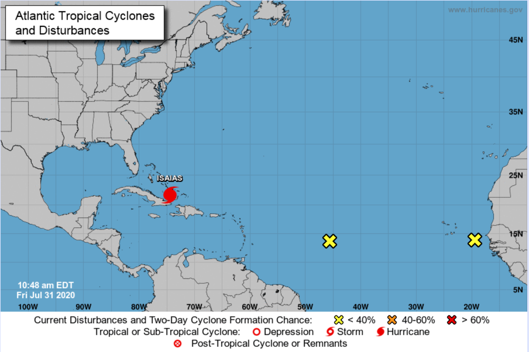
Town Manager Tom Harmer urged Longboat Key residents not to let their guard down because of the uncertainty of Isaias’ track and two other disturbances in the Atlantic Ocean as of Friday morning.
“I think this storm, like many storms, you'll hear the forecasters talk about the uncertainty in the forecast,” Town Manager Tom Harmer said. “It just highlights the need to really pay attention to the weather regularly.”
Harmer said he works with the town’s department heads to make sure preparations are made, including ensuring staffing is ready, having signs up in case of heavy rains or floods, checking power generators and making sure the town’s vehicles have enough fuel.
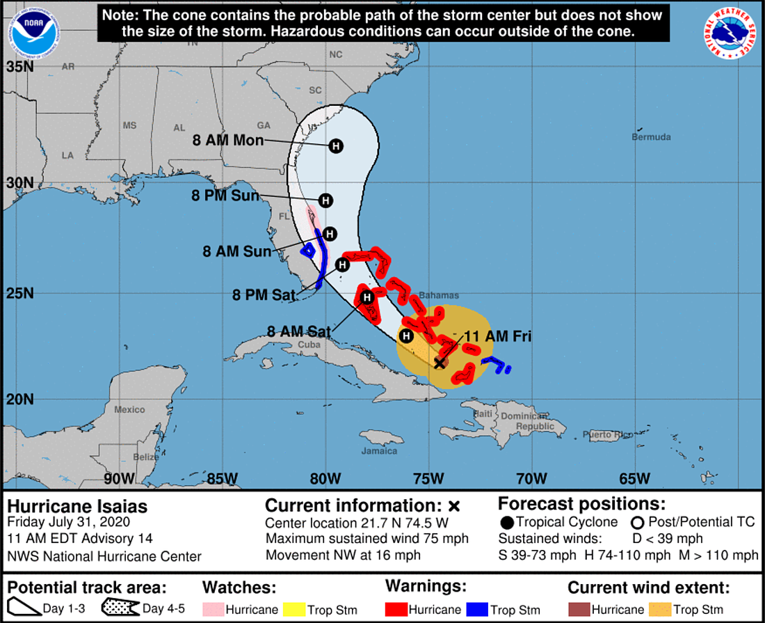
Fire Chief Paul Dezzi said if there is any chance the storm is forecast to come close to Longboat Key — which it is not as of the 11 a.m. ET Friday update from the National Hurricane Center — the town would have a conference call for further discussion.
The NHC has issued a hurricane watch for portions of Florida's east coast. A hurricane watch means that hurricane conditions are possible, whereas a hurricane warning means that hurricane conditions are expected.
As of 11 a.m. Friday, Isaias is a Category 1 hurricane with maximum sustained winds of 75 mph. Isaias is about 365 miles south-southeast of Great Abaco Island and 295 miles southeast of Nassau. It is forecast to come near the east coast of the Florida peninsula Saturday afternoon through Sunday.
Like with the threat of any tropical storm or hurricane, Harmer recommended people to have a plan.
“The key is to act early, especially because we’re a barrier island and if for some reason we were under some threat, and there was an evacuation order, you don’t want to wait until then to decide where you need to go, especially this year with COVID-19. Public sheltering in both [Manatee and Sarasota] counties is much more complicated this year because of the pandemic.”
The counties’ shelters are not able to accommodate the same number of people compared to previous years because of social-distancing requirements.
COVID-19 testing sites in the Sarasota-Manatee area will remain open this week. Initially, the Florida Division of Emergency Management announced plans to close all-state supported testing sites ahead of Isaias. However, the department reversed course because of the updated forecast.
According to the NHC, tropical storm conditions are possible along parts of Florida’s east coast on Saturday. Heavy rains associated with Isaias may begin to affect South Florida and east-Central Florida starting late Friday night. On Saturday and Sunday, fringe showers and storms are expected throughout Sarasota and Manatee counties.
Harmer acknowledged some of Longboat Key’s lower-lying areas — portions of Gulf of Mexico Drive on the north end of the island and Lyons Lane — have flooded with previous storms.
“Ultimately, we’re a barrier coastal island that can be susceptible to overall impacts of any type of tropical event,” Harmer said.


