- August 3, 2026

-
-
Loading
Loading
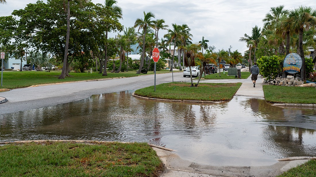
Broadway Street was once the main street on Longboat Key. Now it’s a main example of incessant flooding on the barrier island.
Scott Anderson, a Longboat Key Village resident for 15 years, recalls tearing his drywall out the morning after Hurricane Helene in 2024.
“I’ve lived on the beach all my life. I’ve never seen water come up as fast as it came up. It was just a matter of like an hour,” Anderson said.
But it doesn’t take a perfect storm like Helene to cause flooding in the Village — just a high tide and minor rain. On the morning of July 30, a quick storm rolled over Longboat Key leaving a little more than an inch of rain. At several intersections in the Village neighborhood, pooled water remained hours after the storm subsided. A peek into the storm drain on Bay Side Drive that day showed a reflection of the onlooker just below the grates.
“It’ll stay flooded for maybe a day or two and then it goes down,” Anderson said. “It’s not something that stays for weeks at a time. Pretty much when it goes to low tide, everything gets sucked out.”
With flooding a continual problem in not just the Longboat Key Village neighborhood but several other historic neighborhoods on the barrier island, the town has a four-pronged Resiliency Project plan for the Norton Street, Longboat Key Village, Sleepy Lagoon and Buttonwood communities. Design work is nearly finished for the Sleepy Lagoon community.
In the Village, design work is just underway. Surveyors plotted the area in late July. That’s the first step in design work for a resiliency project in the neighborhood aimed at reducing flooding.
Longboat Key Project Manager David Kushnir said an engineering firm will use the survey data to model how changes to the drainage system, street raising and other potential improvements could alleviate flooding in the neighborhood.
“The first step of design is you determine the topography, the property lines, setbacks, the makeup of the soil, locate any and all utilities, and this way the engineer knows what they’re working with,” Kushnir said.
Anderson is in a good spot as his house sits on one of the highest locations in the neighborhood, about 9 feet above sea level. His neighbors are less lucky.
“Broadway (Street) gets flooded. Anything lower than maybe 5 feet above sea level, they’ll get flooded,” Anderson said. “There’s just no place for the rain to go.”
The survey work began phase 1 of design for the resiliency work in the Village neighborhood.