
- June 30, 2026

-
-
Loading
Loading
The Sarasota-Manatee Metropolitan Planning Organization is responsible for updating its long-range transportation plan every five years, but the regional transportation body wasn’t going to make cursory revisions to previously established plans for this year’s update.
The long-range plan outlines the vision for growth over the next 25 years as it pertains to the transportation network. Following the adoption of the 2040 plan in 2015, the federal government established new criteria for distributing state and local transportation funds, which shifted the MPO’s focus as it began putting together the 2045 plan.
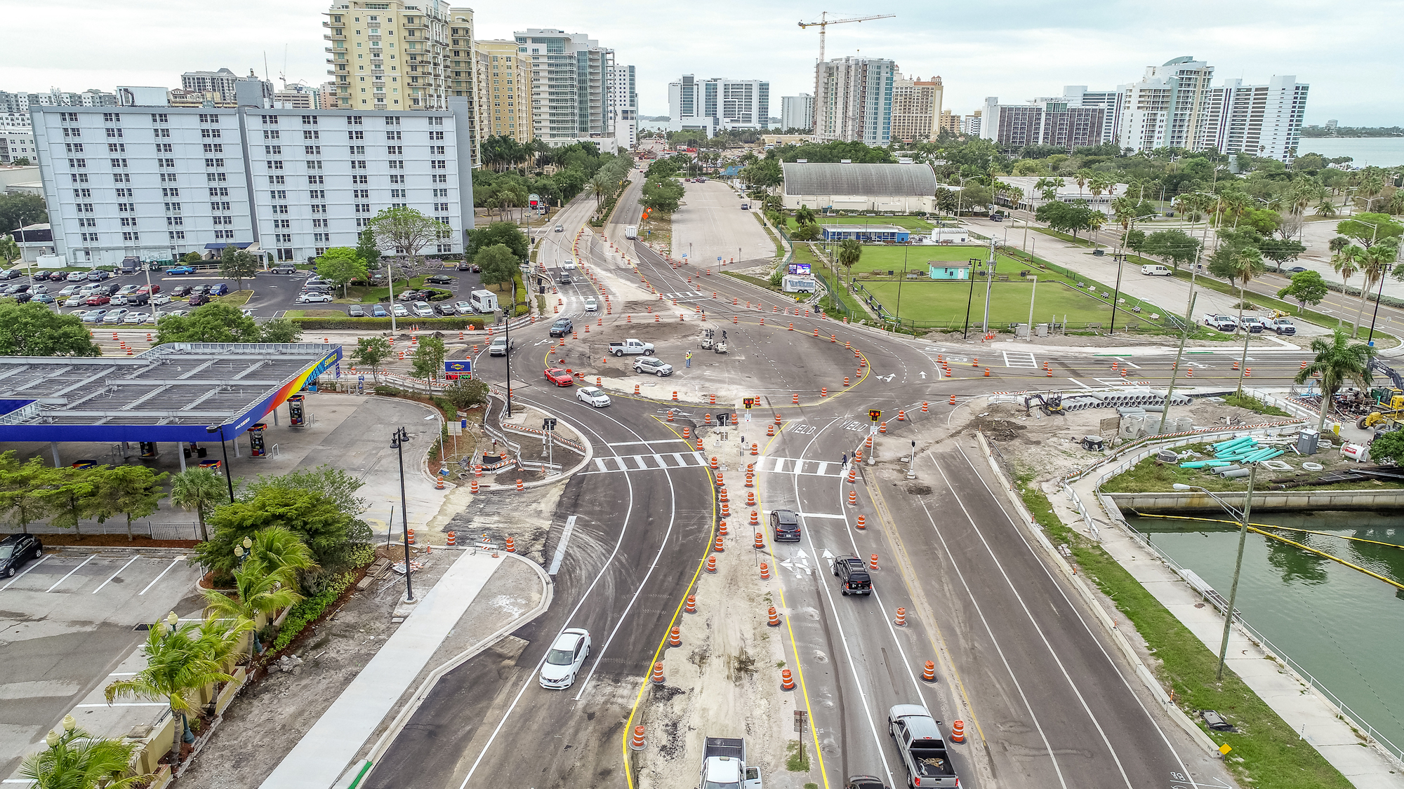
Before, the long-range transportation plan focused primarily on congestion management and motor vehicle-focused road improvements. That’s no longer the case. The draft 2045 plan includes 12 chapters focusing on such topics as multimodal transportation, technology, the economy and the environment.
“It is significantly different than the 2040 plan or anything before that,” said Leigh Holt, the MPO’s strategic planning manager.
To put together a new type of plan, the MPO wanted to be sure it conducted an outreach campaign to the public and to local governments. The MPO spent more than two years developing a list of priorities, conducting technical analysis and compiling a list of transportation projects local officials are pursuing.
The final product includes a plan for how to spend more than $2 billion in transportation-related investments over the next 25 years. Here’s a breakdown of some of the key aspects:
The MPO continues to allocate money toward traditional road construction and widening, budgeting more than $200 million in the long-range plan for projects under that banner in unincorporated Sarasota County alone.
But the 2045 plan places an increased emphasis on alternate modes of transportation, which Holt said is responsive to community demand for walking, biking and transit options. The plan sets aside $300 million for unspecified “multimodal corridor projects” on major roads including U.S. 41, University Parkway, Fruitville Road and Stickney Point Road. It also dedicates $25 million toward bicycle, pedestrian, trail and transit projects.
Holt said that, even for residents who are reliant on their cars, improved multimodal transportation options could offer benefits in the form of removing motor vehicles from the roadway.
“If someone else walks and bikes, then they can get there faster,” Holt said.
Holt noted that, through a partnership with the Florida Department of Transportation, the MPO and local governments could create an additional $118 million to support the construction of new local roads to serve future development.
In various forms, the 2045 plan identifies a litany of locations the MPO envisions as hubs.
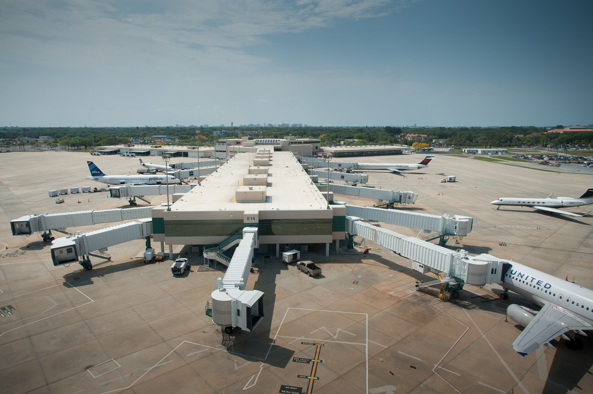
Along U.S. 41, the areas around University Parkway, Fruitville Road, Bee Ridge Road and Stickney Point Road are labeled “multimodal employment centers.” Those four streets are identified as “higher education/high-tech corridors.” U.S. 41 and I-75 are highlighted as “regional employment corridors.” The area around Sarasota-Bradenton International Airport is labeled as an “economic center.”
The MPO believes mapping out areas where jobs, vehicles and regional destinations are likely to be concentrated provides multiple benefits. It helps create a reliable guide for growth, letting officials know where people will be in the future — and where they will be traveling to, which allows for more effective long-term planning. That knowledge is useful to the public, too, as they make long-term investments in the community. And it provides economic benefits, creating robust nodes with modern transportation infrastructure built around a cluster of businesses or other activity-generating places.
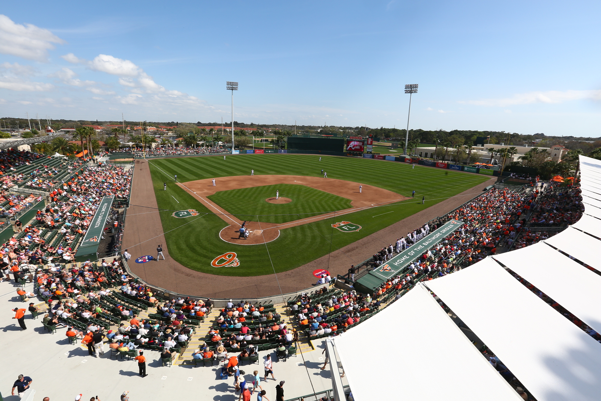
One other activity hub identified in the 2045 plan’s vision map are “tourism centers,” a sign of the MPO’s interest in addressing the atypical patterns associated with attractions for visitors to the area.
The MPO hopes to achieve that in part by focusing on beaches and baseball stadiums. Holt said the beach-focused improvements could come in the form of bridge replacements and improvements on corridors to the barrier islands and dynamic signage to let people know if a public parking lot is full before they arrive.
The organization set aside $500,000 toward planning possible access improvements to Ed Smith Stadium in the city of Sarasota. Because the region’s spring training stadiums get the bulk of their use for just one month of the year, Holt said planners have to get creative to effectively handle that spike in activity without negatively affecting the road network the rest of the year.
“You’ve got a lot of people coming at particular times,” Holt said. “You need people to be able to drive in, need to be able to walk, and we need to manage event traffic.”
The 2045 plan attempts to take a more comprehensive look at the future of transportation in the region than the MPO has in the past. That includes an emphasis on how the environment and technology will evolve over the next 25 years.
The environmental chapter of the 2045 plan encourages focusing on infill development to limit sprawl and encourages planners to consider ecological impacts when considering new projects. The document also outlines some mitigation options for avoiding damage to water resources and natural areas.
The technology chapter details how advancements on that front can lead to a more efficient transportation network. That applies both in the near-term, such as improving and expanding the regional Advanced Traffic Management System already in place, and long-term, as the organization is mindful of the forecasted increase in autonomous vehicle use over the next 25 years.


