- July 13, 2026

-
-
Loading
Loading
June 1 is not a holiday, but it is a day of note for all Florida residents because it marks the first day of hurricane season.
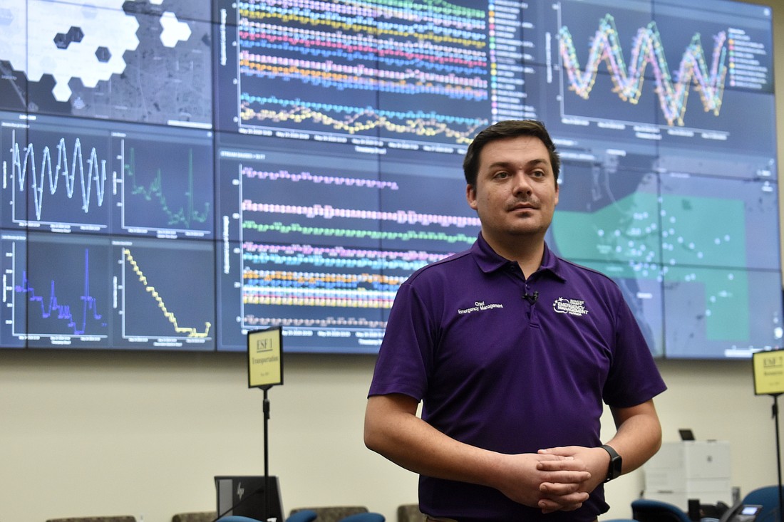
In preparation for the season ahead, Manatee County rolled out its new high water vehicle and offered a glimpse of its latest storm software at the Emergency Operations Center May 27.
“It is an amazing asset,” Chet Brown, the division chief for Public Safety, said of the high water vehicle. “The citizens should know if there’s an issue, we’re coming to get you.”
The $236,155, custom-built truck, that Brown nicknamed “the Rhino” because of its size, can drive through 48 inches of water and rescue up to 30 people at once.
Brown noted that during past rescues, the boats could only pick up one or two people at a time. Plus, the Rhino can get in and out of flooded areas much quicker.
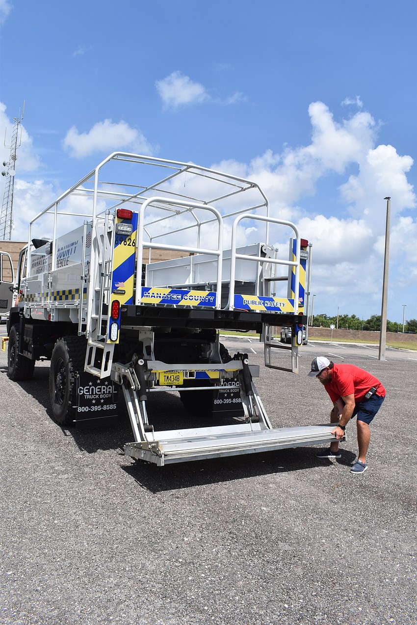
It’s also fully accessible because of a lift gate in the back. Residents who are bedridden and use wheelchairs can be loaded onto the vehicle. The lift can also lower to meet the water level, so a boat can pull onto the gate and people can unload straight into the back of the truck.
For such a large vehicle, Brown said it’s easy to drive. It has an automatic transmission and can travel up to 75 mph, although no one has tested it at that speed.
The Rhino stays parked at a county fleet station near Cortez Road and 66th Street West because it’s easy to access for the beach patrol.
Beach patrol members take swift water training classes and have been trained to operate the high-water rescue vehicle, but the vehicle is a countywide asset.
If a hurricane were approaching and the eye was headed toward Myakka City, staff would find a safe place to park the rescue vehicle in or around Myakka City.
Time matters when rescuing people from a flood.
“The longer they’re there, the more hazards present themselves — floating debris, electrical issues — a lot of things can happen,” Brown said. “The quicker we get there and get them out of the situation they’re in is best.”
The vehicle's cab seats three, but if put into use, it’s more likely that two staff members will be in the cab and two will be in the back assisting residents.
The high water vehicle was delivered at the end of last year, so it hasn’t been put to a real-life test yet. But the Peregrine software has been used through three hurricanes and has produced some impressive results.
The software was being installed during Hurricane Debby in August 2024. The software was expanded throughout the next two hurricanes — Hurricane Helene and Hurricane Milton.
The software that started during Hurricane Debby with about a dozen data points, such as stream gauges and lift station calculations, expanded to over 50 data points throughout the next two months and two hurricanes.
The initial cost for the software was $140,000, and the expansion cost $267,500.
The software itself is not new. It’s long been used by fire departments and law enforcement agencies to consolidate data. But Manatee County is the first municipality to aggregate data for use through a natural disaster.
The software doesn’t discover new data or solve new problems, but it organizes data so efficiently that Director of Public Safety Jodi Fiske contends it saves staff days worth of time during a hurricane activation.
“Not that (the same decisions and responses) wouldn’t get done before, but we’re doing it faster now,” she said.
Manatee County’s hurricane damage assessments were compiled 12 hours after Hurricane Helene. The average is 24 hours or more. Manatee was waiting on other counties to finish, so the state could submit its assessment to the Federal Emergency Management Agency.
Matthew Myers, chief of Emergency Management, said the state is looking into launching a pilot program within this region in the hope of eventually using the system statewide.
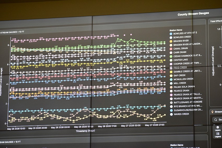
Myers illustrated the advantage of Peregrine by explaining how the county's stream gauges used to be monitored during storm events.
Each gauge had its own screen. The user had to click back and forth between 24 tabs, which can cause occasional user errors when compiling so much data.
With Peregrine, the gauge measurements are side-by-side and color coded within a line graph. Staff can watch the lines rise and lower in nearly real time. The refresh rate can be set to every two minutes.
Additionally, the data is "verifiable," which means there is electronic proof that the data is unaltered and from a reliable source.
Peregrine consolidates data to quickly and accurately determine flood threat levels — minor, major or action stage.
The software can pull from all county data and then strip it down to only what's useful.
Parks, for example, have layers of information on the county website, such as the hours and if dogs are allowed. In Peregrine, only necessary information is in the "dashboard."
And even parks became a crucial county asset when dealing with disasters.
Off the top of her head, Fiske rattled off a slew of questions about parks that she needs answered during a hurricane activation:
How big is the park? What does the entrance look like? Is it paved? Can I land a helicopter? Could I put semi-trucks there with the National Guard?
"All of that information is already there (in Peregrine)," Fiske said.