- June 19, 2026

-
-
Loading
Loading
After the confusion during the last attempt at creating a canal maintenance program, commissioners agreed on one thing: it’s time to get some new surveys.
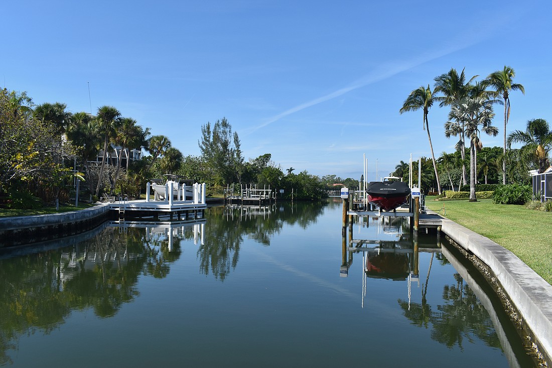
The last time Longboat Key’s canals were surveyed was in 2016. From March 24 to 31, survey crews will be on the waters of Longboat Key, conducting updated conditional surveys to figure out what is needed to get Longboat’s canals back to baseline.
Assistant Public Works Director Charlie Mopps said one of the problems that commissioners debated at the end of last year was the $17 million price tag that came with the initial cost of a canal maintenance program.
That cost was to re-baseline the town’s 81 canals to get them back to normal conditions. Hypothetically, after that would be completed, then a maintenance program would be implemented.
But commissioners worried about rushing into the baseline work, which would have been another assessment for the town. It was a tight deadline to get the program approved if it was to be on the 2024 tax roll.
Taylor Engineering and Anser Advisory, LLC presented an initial plan to Longboat Key town commissioners in November 2023, which left commissioners with more questions than answers. The plan included dividing the town’s canals into seven groups and classifying each canal based on their use.
The plan was complicated enough to stop the presentation dead in its tracks, and it required Mopps to meet with commissioners one on one before going back a month later.
Mopps said that some of the commissioners who spend time boating around Longboat questioned whether the same baseline dredging effort was needed in all the canals.
At the end of the commission meeting in December 2023, commissioners directed Mopps to resurvey all the canals.
“We were looking at numbers that were generated from 2014 to 2016, which was the old survey,” Mopps said. “It’s already been 8 to 10 years … what are the conditions of those canals, and let’s try to come up with some engineered solutions to try to reduce the overall cost of the program.”
Another suggestion taken by Mopps was to get a second opinion on the surveys.
“They wanted to get a fresh look on it, too,” he said.
Taylor Engineering conducted the last canal surveys, and the company has a long-standing relationship with the town, according to Mopps.
But for the new surveys, Mopps said the town decided to bring on Coastal Engineering Consultants and First Line Coastal. Both have a history of working with the town, including projects like the beach nourishment project in 2021, Beer Can Island dredging and the recently-completed New Pass Groin project.
Mopps has a longer history working with Coastal Engineering Consultants from his time in Charlotte County. There, he said the firm helped manage the county’s maintenance dredging program for over 20 years.
The updated surveys will be useful to compare to the previous survey from 2016. They will give Mopps and the project team insight into the status of the canals and how the sands may have shifted in the last 10 years.
Mopps said one objective of the comparison is to explore alternatives to reduce the overall cost that initially concerned commissioners.
For example, Mopps said the ocean floor immediately to the right or left of access channels may be deeper than the channel itself. In that case, it may be more cost-effective to move the channel markers and save on the cost of dredging the canal.
The crews will be navigating Longboat’s canals from March 24-31, conducting a conditional survey.
“What this will do is give us an idea of what the conditions are right now,” Mopps said.
The boats used by the survey crews have multi-beam sonar, and take close to 100 shots a second, Mopps estimated. Those images are relayed back to base stations that are calibrated on land.
Those images are then processed through software, like HYPACK, to be analyzed and show what the bottom of the canals looks like.
Mopps said after a week or two of survey work, it will take another two weeks to compile the results and get the data into a usable format.
Before going back to the commission, Mopps said he hopes to be able to make recommendations about how the initial costs can be reduced given the new data.
He said he plans on bringing the results before the commission around May, before the summer recess and while the budget process is still ongoing.


