

- June 23, 2026

-
-
Loading
Loading
Longboat Key residents took a test drive last week, but not of a snazzy, new roadster or a sensible, frugal hybrid.
In fact, no one got behind the wheel or shifted into gear.
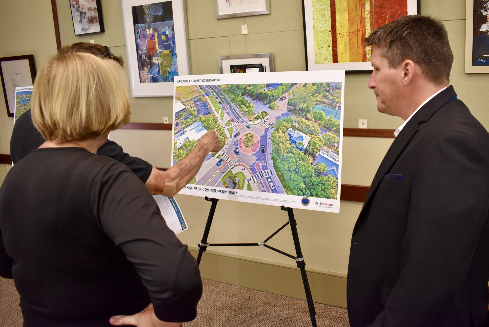
But about 25 people, including a handful of elected officials, did indeed keep their eyes on the road — Gulf of Mexico Drive, specifically — in a Town Hall try-before-you-buy session highlighting the vision for the island’s largely two-lane thoroughfare.
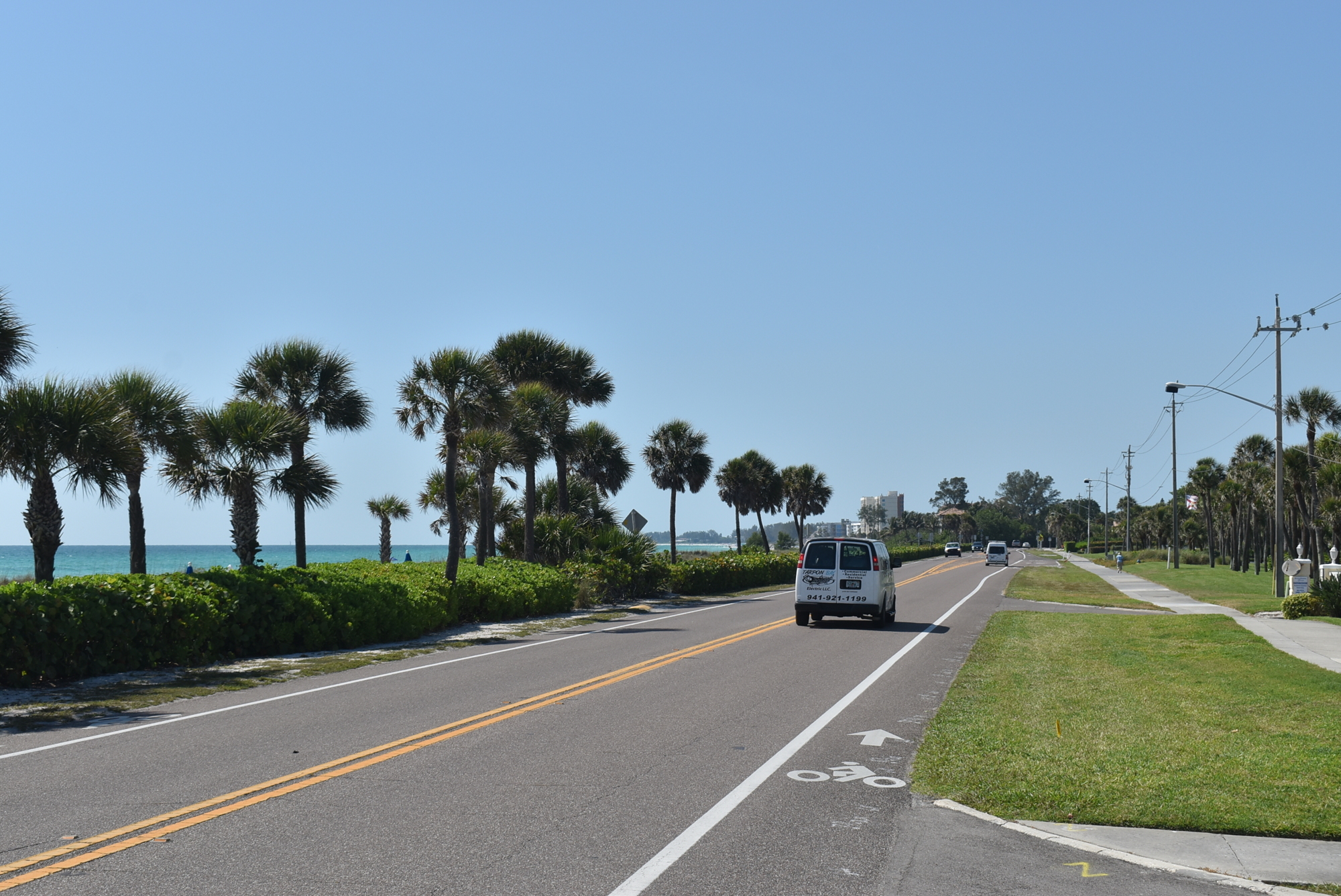
Measuring 10 miles from drawbridge to drawbridge, Gulf of Mexico Drive is at the same time a residential street, a tourism artery, a commercial boulevard, a fitness route and a segment of a state-controlled road that extends 18 miles from Sarasota’s bayfront into the middle of Holmes Beach.
Five traffic crashes involving motorists, pedestrians and cyclists have killed six people since May 2018 on Gulf of Mexico Drive.
Town leaders and consultant Kimley-Horn have for months been working on proposals to one day make Gulf of Mexico Drive safer for everyone through a series of upgrades to cycling lanes, crosswalks, adjacent multiuse pathways and tricky intersections.
Called a Complete Street Corridor, project manager and Kimley-Horn senior planner Colleen McGue said, the idea is to “provide people safe and comfortable travel options regardless of their mode of travel.”
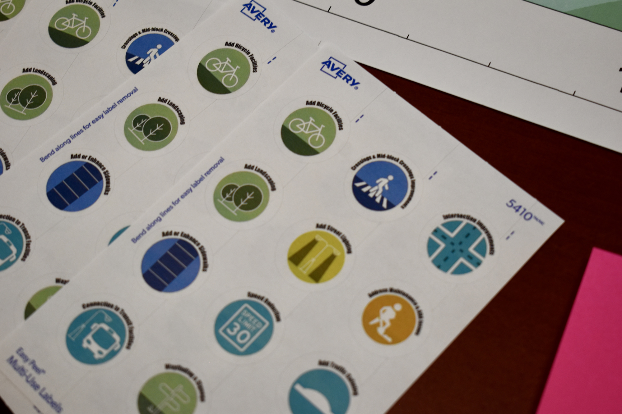
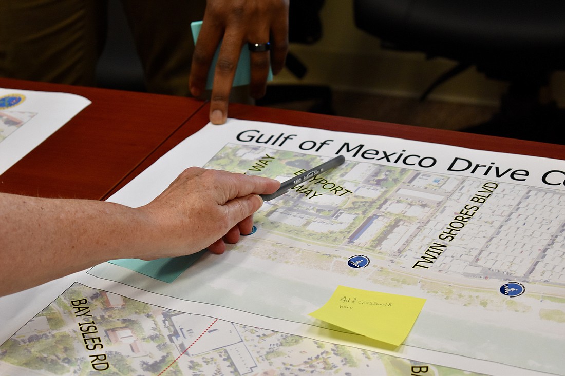
Through a presentation, a Q&A and opportunities to mark up giant maps of the Gulf of Mexico Drive corridor with stickers and Post-its to note specific ideas and locations, residents weighed in what they liked, what they didn’t made and suggestions that had not been previously envisioned.
Resident Lenny Landau cautioned planners to carefully consider where crosswalks are proposed, saying he sees plenty of people crossing within sight of a marked path across the pavement because many of the actual crosswalks “go from someplace to no place."
“If they’re there, they don’t use them because they don’t go where they want to go," he said. “You need to pick the spots. … Up at the north end at Broadway is a good example of people who go from here to there. But to put one in the middle of the street where there’s a condo on one side and nothing on the other, they just don’t go to it."
Residents of Bayport, just south of Bayfront Park along the only stretch of Gulf of Mexico Drive with beach immediately to the west, raised a point to town officials that theirs is the exact opposite situation.
A trip across Gulf of Mexico Drive to the beach there can be a harrowing one, in some places traversing an extra lane of traffic or two, when accounting for a turn/acceleration lanes, to one of just a few breaks in an adjacent parallel hedgerow.
Not that a crosswalk in that area is a new idea.
Well, an officially sanctioned one, anyway. Nearly 20 years ago, residents one January morning awoke to hand-painted pedestrian-crossing stripes leading from near Gulfshore to the beach. Then-Public Works Director Juan Florensa saw it on his way to work that morning and notified FDOT.
It was quickly painted over in black.
“ I think it had to be a two-man job, and I don’t know how they could have done it without being seen by motorists,” a resident told the Longboat Observer in 2004, adding what really was needed was a pedestrian bridge.
No bridge is part of the proposals the town is looking at, but resident upon resident of Bayport e-mailed Town Hall seeking a reduction to 35 mph and requesting a crosswalk that lines up with one of the pathways through the hedge.
Ben Johnson, a full-time Bayport resident who attended the Town Hall workshop, said an official crosswalk would be a big help. Town officials reminded residents of limitations on what can be built in 45 mph zones, and how unlikely it was to win a lower speed concession from FDOT.
A so-called switch-back crosswalk, which features a refuge for pedestrians halfway across, would be “nirvana" for the community, Johnson said, especially when coming back from a sunset visit to the beach as darkness is falling. “This is not one of those places where there’s a crosswalk to no where."
“The problem is that traffic is starting to become pretty intense," Johnson said. “A lot of us are older, 60s, 70s, 80s, and we walk a little slow, so it’s pretty hard to judge whether you have a big enough gap.”
Public Works Director Isaac Brownman said there are 13 connections to Gulf of Mexico Drive in the roughly half-mile south of Bayfront Park, including Bayport, Twin Shores and Gulfshore. “We know this is a zone where people like to cross where ever, because the beach is right there," he said, adding FDOT said the nature of the highway at that point is unlike any other on the island.
He said FDOT officials inidicated it might be similar to a school zone or a wildlife-crossing zone, but no one was interested, really, in setting a slower speed limit there commensurate with such an off-the-shelf traffic solution.
“But they’re willing to be creative and think outside the box because it’s such a unique segment," Brownman said.
While some residents expressed an interest in a bikes-only pathway instead of a sidewalk on the west side, the consensus of avid riders was for a wider and better-buffered pair of lanes for cycling within the boundaries of the roadway.
Today’s bike lanes are four feet wide, with a single stripe separating the motor-vehicle lanes. Proposed is a seven-foot wide bike lane that includes a two-foot wide transition zone, marked by double stripes.
Previously, commissioners leaned away from reflectors or rumble strips in the transition zone, but supported painted lines that give drivers a sensation of their wheels leaving their portion of the roadway.
Kimley-Horn’s initial recommendations included conversion from 45 mph to 35 mph speed limits in three zones, the northern end, the southern end centered on Country Club Shores and a mid-island segment roughly from Bay Isles Parkway to Bayfront Park.
Town commissioners have recommended sticking with 45 mph speed limits. With new state guidelines, the town’s existing crosswalks augmented by yellow flashing lights are no longer permitted to be built in 45 mph zones, though they are allowed to stay for now.
The only crosswalk signals allowed in 45 mph zones are the more-expensive red-light equipped pedestrian-hybrid beacons, which carry the same traffic regulations as a stop light. Two such lights were proposed to replace the yellow lighted-crosswalks at Bayfront Park and Longboat Key Club Road.
Following the public outreach portion of the project, Kimley-Horn will work with FDOT and other agencies and the town to finalize plans and perhaps group them in phases and work out cost estimates. Remaking the road along its entirety as one project is likely cost-prohibitive.
The town and Kimley-Horn tentatively plan for a package to be presented to the commission by the fall, though state funding would still have to be sought through the Sarasota-Manatee Metropolitan Planning Organization.


