
- June 23, 2026

-
-
Loading
Loading
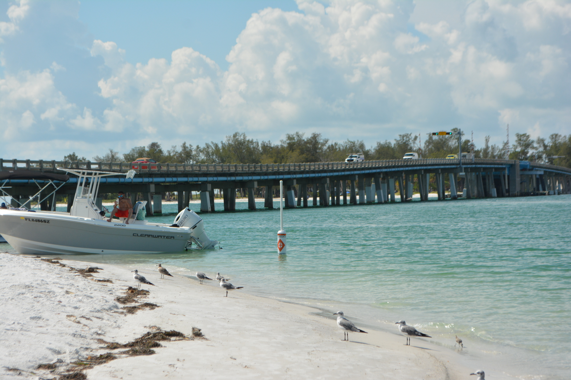
Boaters looking to beach on Greer Island, known locally as Beer Can Island, are now restricted to half the area after signs and buoys restricting access were placed along the shoreline of the popular northern Longboat Key destination.
The signs follow an emergency dredge that was completed about two weeks ago.
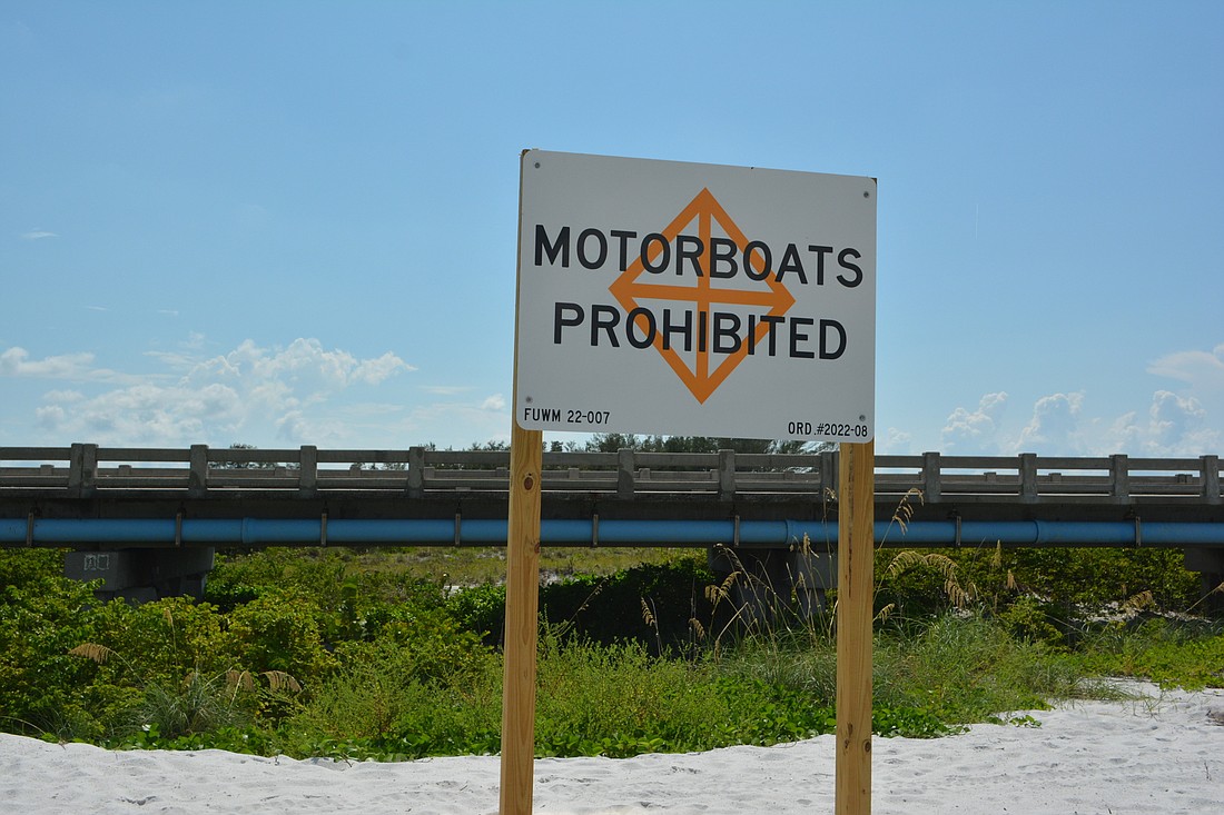
Signs enforce the newly permanent rules, which only allow swimmers, kayakers and paddleboarders in the restricted zone. Town officials were set to enact the no-motor zones earlier but had to reset and re-clear their plans with state officials following the emergency dredging, which changed the landscape of the area somewhat.
Buoys were placed shortly after the signs. Both state that motorboats are prohibited to enter and beach in the zone.
Motorized vessels will still be allowed to beach and anchor in unrestricted areas of the spit just past the buoys and under the bridge.
“(The restricted zone) will extend from a point a little northward of the dock, about 180 feet to the north and then that zone will conclude,” Public Works Director Isaac Brownman said in a “Talk of the Town” segment. “There is no restriction beyond that as you head west under the bridge.”
Restrictions are placed on boaters, keeping them away from the dockside area in hopes of reducing noise levels and moving sand back into the canal.
A navigation zone will be maintained and enforced in the narrow channel that connects the Greer Island lagoon to Sarasota Bay. Property owners along the lagoon and first-responder vessels will have access to the area.
The signs come after an emergency dredge was completed to move sand away from the Land’s End dock. Property owners of Land’s End dock right by the bridge had reported the sand reaching up to their dock, creating a hazard and a nuisance.
Brownman said the sand likely came from beach nourishment projects that occurred west of the bridge.
“Over time the way the currents and dynamics work on this part of the island, a lot of this material would either wash into the pass and we could dredge it back out,” he said. “Some of that material would actually wrap around and deposit here where the velocities are slower and the currents are slower.”
Crews worked to reopen the passage between the lagoon to the west and Sarasota Bay to the east for wildlife access, tidal flushing and boats. About 1,500 cubic yards of beach-compatible sand was removed from the waterway in the project that cost about $117,000.
Sand dredged into the large mound by the bridge is planned to be moved and placed back on beaches on the Gulf side of the bridge. The project is planned for completion by the end of the year.
Town staff intend to continue dredging the area as needed to maintain the area and keep the sand from building up to the point necessary for the emergency dredge project.
Permits for that work have been issued by the Florida Department of Environmental Protection, the U.S. Army Corps of Engineers and the Florida Department of Transportation. The town plans on seeking bids this fall with potential completion dates by the end of the year or early 2023.
Beyond Canal 1A, the waterway from the lagoon into the bay underneath the bridge to Anna Maria Island, the town is also working on a plan to systematically dredge all 81 town-maintained canals, with permitting in progress. Additionally, the town is seeking permitting to build a seagrass mitigation area to compensate, as required, for seagrasses harmed in the process of canal dredging.
The town is also working on a plan to finance such an endeavor and with landowners fronting private canals before work on public canals begins.


