- June 19, 2026

-
-
Loading
Loading
Vishal Kakkad, the traffic engineering division manager in Manatee County, said the county is making headway when it comes to using technology to lessen traffic congestion.
In March, the division was named a co-winner, alongside the Florida Department of Transportation, of the Agency Improvement Award from the National Operations Center of Excellence. The center is a partnership of the American Association of State Highway and Transportation Officials, the Institute of Transportation Engineers and the Intelligent Transportation Society of America, with support from the Federal Highway Administration.
"It made me proud of my team," Kakkad said of the award. "They make it work. It is a national industry recognition of our efforts we are making in our small part of our world here."
Whether Manatee County residents understand that effort is debatable. The region's tremendous growth can overwhelm Manatee County's best efforts to relieve traffic congestion.
Offering an example of rising traffic levels, Kakkad said the volume on East County's Upper Manatee River Road is in the 20,000s of vehicles each day while just five years ago it was closer to 10,000 vehicles a day.
However, he said the new technology that led to the award will continue to boost speeds on the roadway while maintain safety.
He said his department's advancements in technology date back to 2010, when the Florida Department of Transportation began funding the Advanced Traffic Management System in Manatee County.
“That laid the groundwork for a lot of things that we do,” he said. “Since that point onward, the county's staff has strategically continued investment (in technology). As our new projects come, we incorporate those things.”
Since 2010, the county has been installing Automated Traffic Signal Performance Measures, which provide real-time and historical data about the use of traffic lights, and Adaptive Signal Control Technology, which allows traffic signals to adapt to the changing uses of roadways.
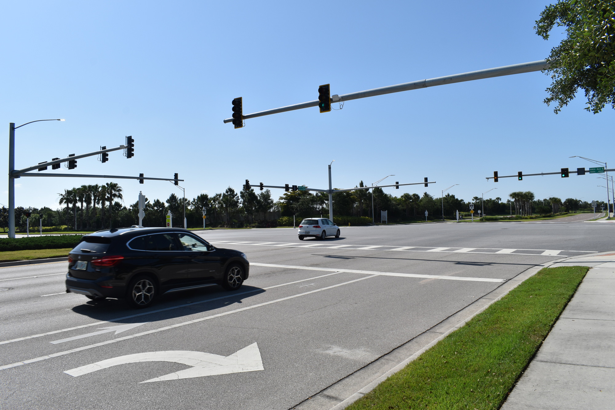
Kakkad also highlighted some of the projects that will increase pedestrian safety, especially amid increasing levels of traffic, such as the Leading Pedestrian Intervals being implemented on multiple roadways, including the intersection of 44th Avenue and White Eagle Boulevard in Lakewood Ranch. Pedestrians are given time to cross the intersection when all lanes of traffic are stopped.
However, the most important addition to helping the traffic flow came in 2019, when Manatee County implemented ASCT measures at 20 intersections through a $1 million grant from the Federal Highway Administration.
According to the county’s statistics, ASCT typically lowers travel times by as much as 20% when it comes to passing through busy intersections. Kakkad said ASCT is used currently on University Parkway, among other busy roads, soon will be coming to most intersections along 44th Avenue and Lakewood Ranch Boulevard.
Clarke Davis, deputy director of traffic management at Manatee County Public Works, said the technology systems can help manage congestion in major areas such as State Road 70, University Parkway, State Road 64, US 41 and DeSoto Bridge, US 301, Cortez Road, Lakewood Ranch Boulevard, 53rd Avenue West, Lockwood Ridge Road, and Upper Manatee River Road. He said Lorraine Road is also sensitive to interstate conditions.
“The day the bad thing happens on I-75, you're more likely to need to make an adjustment,” he said of the fact motorists can clog other arteries when forced off the interstate.
Signals using Adaptive Signal Control Technology have special hardware and software to continuously monitor the traffic corridors, and can adjust their timing based on the information they receive. Fiber-optic cables, which connect 95% of traffic signals in the county, communicate with the county's traffic center to allow staff members to make adjustments, as well as communicate with the other signals to improve timing.
In simple terms, if few cars are using one cross street, the green light allows traffic to flow along the busier road.
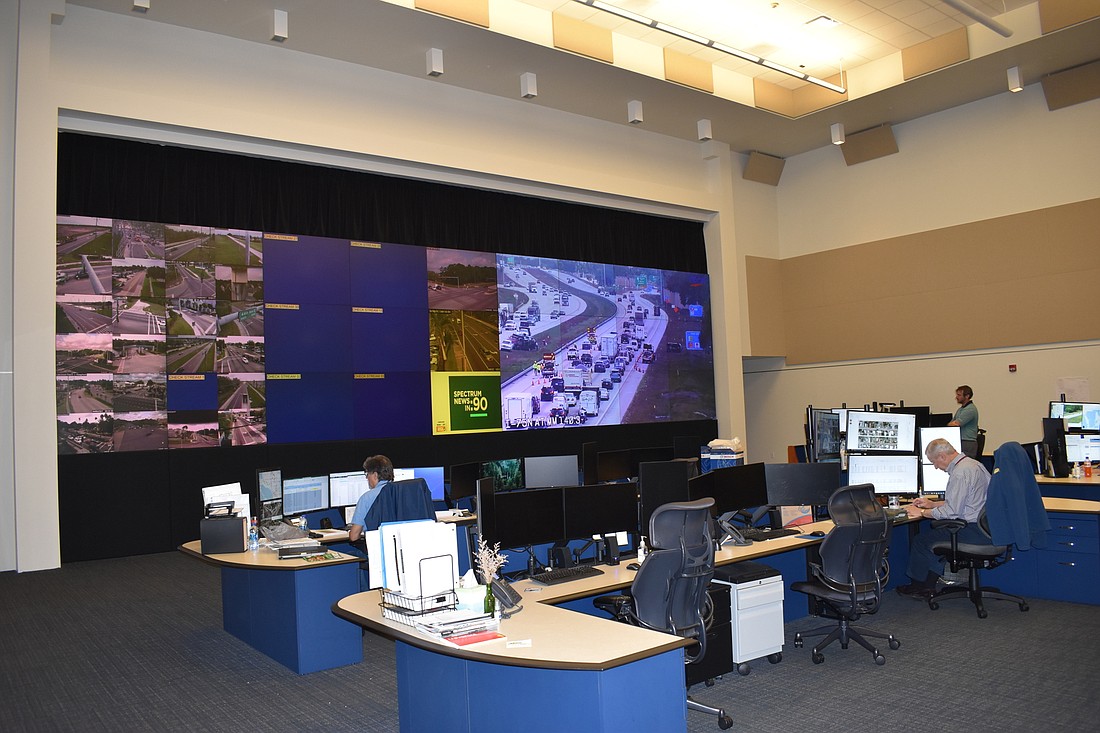
Davis said that while the computer systems at these traffic lights are helpful for managing traffic, the public must not underestimate the work the department performs, including intervening in the decisions of the computer systems. The human element remains vital as cameras provide feedback to the traffic center.
At the Traffic Management Center, located in the Public Safety Building on 47th Terrace East, staff members sit in front of a large projection screen displaying live feeds from different roadways, examining conditions.
"You need a lot of care from our team, investment from our leaders, and growth as we continue into the future,” Kakkad said.
Kakkad said the signals can be managed from the center, without any need for staff members to travel into the field.
“If there is an incident out there, then we are able to affect signal timing changes from here,” he said. “Traditionally, we would take a slice of time and our folks would go analyze and put in a signal timing plan. This is the next generation.”
Clarke Davis said staff members need to intervene during an extraordinary event, such as a crash. He said operators seek to “balance” the intersection.
Sometimes, keeping a main thoroughfare open longer can be annoying for drivers on side roads, but the net benefit is that traffic keeps moving.
Feedback provided by technology is studying and more permanent timing changes can be made. For instance, if you are waiting through three red lights to make a left hand turn, perhaps the time on the green light can be extended.
Resident feedback is valuable as traffic patterns are studied.
Kakkad said if motorists encounter traffic signals where the timing appears to indicate a malfunction, they should call 311, as the division’s staff are willing to help.
Davis said, “People will say, 'Hey, I hit every light red today.’ They know it feels wrong. Sometimes the progression just gets messed up for one reason or another, but they usually know before us."
Kakkad said that despite the amount of work performed behind the scene, there is still a responsibility for staff at the department to enter the field as well.
“I'm traditional from that standpoint,” Kakkad said. “When I started my engineering career, there was no Google Street. It was the old fashioned, go out in the field and do the dirty work. I still strongly believe in that no amount of aerial or picture photography is going to do you justice. You have to be there.”
Kakkad said the purpose of the live cameras at intersections is traffic monitoring, not traffic enforcement. The cameras do not record incidents, and the responsibility of traffic enforcement rests with the Development Services Department, which operates the Red-Light-Running Program.
Kakkad said that the county is implementing new systems to increase the safety of pedestrians.
He said that new Rectangular Rapid-Flashing Beacons are being implemented, with installations having just taken place on 44th Avenue and White Eagle Boulevard. He also said that at 11 intersections in the county, in school areas, the county is implementing Leading Pedestrian Intervals.
"Right now, our priority has been areas where there are schools," he said. "And specifically where we have crossing guards present.”
He said the county uses the Waze for Cities app, which helps the county obtain additional data on traffic. Waze shares its data with Google and provides the county with raw data on its users’ speeds and travel times. He said the city of Sarasota and Sarasota County have asked for information about the system to decide whether to use the app.


