
- July 10, 2026

-
-
Loading
Loading
In reality, it would be just a simple pathway, a way to get from one place to another without struggling through mangrove tangles and other hard-to- navigate vegetation.
Police say they need such a path to properly enforce the law and ensure public safety on Greer Island, also known as Beer Can Island.
But there’s more to the path’s creation than chain saws, machetes and a few hours of work. And there are bigger issues, such as beach erosion and governmental paperwork at play. The police need, though, is plainly stated by Chief Pete Cumming.
“I need a path to get out there 24 hours a day, seven days a week,” he said.
Recent reports of excessive alcohol consumption and littering on and around Greer Island has prompted Longboat Key officials to look into ways for police officers to get to the recreational area quickly and consistently using the department’s all-terrain vehicle.
“This is not going to be easy,” said Mark Richardson, Longboat Key’s Streets, Facilities, Parks and Recreation manager.
Over Memorial Day weekend, nearby residents complained the atmosphere on the beach and surrounding locations was like that of a “frat party on the weekends.” It’s not a new complaint. Police have responded to a similar situation in years past. In 2009, two to four police officers patrolled the island every Saturday and Sunday through most of the summer. In one case, a Fire Department ladder was used to help rescue a person in need of medical attention.
A sliver of land, covered in mangroves, connects Greer to the mainland. Because of erosion, Cumming said it’s a challenge for officers to get to Greer by land, especially during high tide.
On June 9, both Richardson and Cumming inspected the area to determine a feasible path. Town Manager Dave Bullock said the path would be just wide enough to allow the police ATV, which is about 50 inches across, to get through.
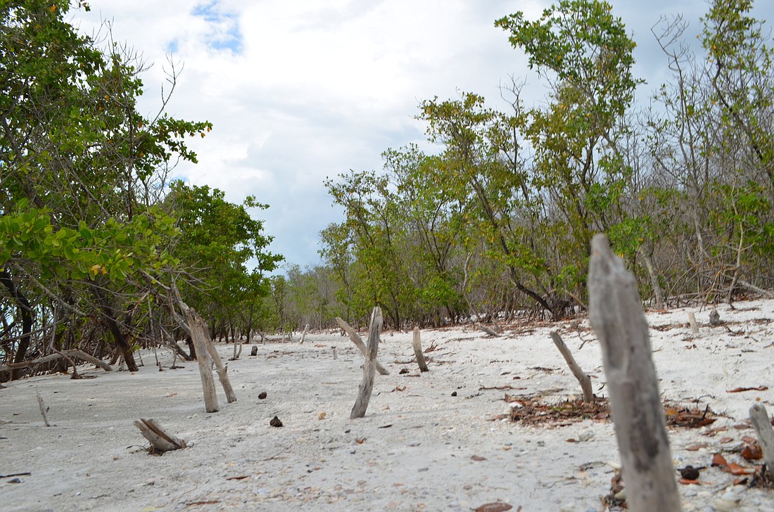
An area ridden with mangrove stumps serves as a walking path to Greer. Richardson said some of the stumps and dead mangroves on the connecting sliver can be cleared away to create a path for the police ATV, but some living mangroves would also need to be removed.
“No matter where we decide to go, some living mangroves are going to have to come out,” Richardson said.
Because mangroves are considered a protected species by the Department of Environmental Protection, Richardson said removal will require a permit, which town staffers are looking into acquiring. If the permit is approved, Richardson said he hopes any removal of living mangroves will be minimal.
Richardson is also determining whether the town will need to traverse property owned by nearby condos to make the path.
While Cumming respects the protected status of the mangroves, he stressed the importance of keeping Greer Island’s visitors safe.
“Human beings need to be protected as well,” Cumming said.
Bigger picture
360 North resident and former National Oceanic and Atmospheric Administration official Bob Bunting is a vocal advocate for addressing erosion at Greer Island. He worries that any removal of mangroves, either living or dead, will put the area at a greater risk of erosion, potentially creating a breach between the gulf and Greer’s lagoon.
While Bunting said he understands the need for Key police to be able to access the area, he would rather see town staff work to expedite efforts to implement a long-term solution for erosion, noting a wider shoreline will allow emergency services to easily access the area.
“It seems to me like a logical way to move forward,” Bunting said. “That would solve a lot of problems that we have.”
The town is moving forward with two initiatives to address erosion at Greer. The short-term fix is dubbed the Greer Island Beneficial Use Project, which is part of a townwide canal dredging project. The town’s plan is to dredge sand from the east side of Greer, where a spit is nearly connecting with the mainland, and use the sand to reinforce the sliver of land on the west side.
That project is expected to begin in second half of 2018.
Olsen Associates Inc., the town’s coastal engineer, will present the Town Commission with options for a long-term solution for Greer’s erosion, including a permeable adjustable groin, in the coming months. Such a structure would trap drifting sand and passively build up sand on Greer’s shores.
A terminal groin on the gulf side of Greer Island was initially proposed with the two near North Shore Road, but the prospect was delayed after Manatee County challenged the plan. In a 2014 settlement, the town agreed not to begin permitting for the third groin until 2019, in return for construction of the other two.
What can be done?
Short-term and long-term options exist to solve the issue of access to Greer Island.
Option 1: Cut a path through mangroves to ensure police and fire-rescue access. Permits would be required to cut endangered mangroves. Removal of living and dead mangroves could add to erosion risk.
Option 2: Plan to dredge town canals would move sand to Greer Island. The sand from this dredge would then be used to deter erosion on Greer Island by reinforcing the sliver of land on the area’s west side. The Greer Island Beneficial Use Project has an estimated dredge volume of 5,000 to 25,000 cubic yards. Construction is estimated to cost between $400,000 and $1 million, plus up to $150,000 for design and engineering fees.
Option 3: A terminal groin on the gulf side of Greer Island was initially proposed with the two near North Shore Road, but the prospect was delayed after Manatee County challenged the plan. In a 2014 settlement, the town agreed not to begin permitting for the third groin until 2019, in return for construction of the other two.
Coming soon
Olsen Associates, Inc., the town’s coastal engineer, will present the Town Commission with options for a long-term solution for Greer’s erosion, including a permeable adjustable groin, in the coming months. Such a structure would trap drifting sand and passively build up sand on Greer's shores.


