- April 26, 2024

-
-
Loading
Loading
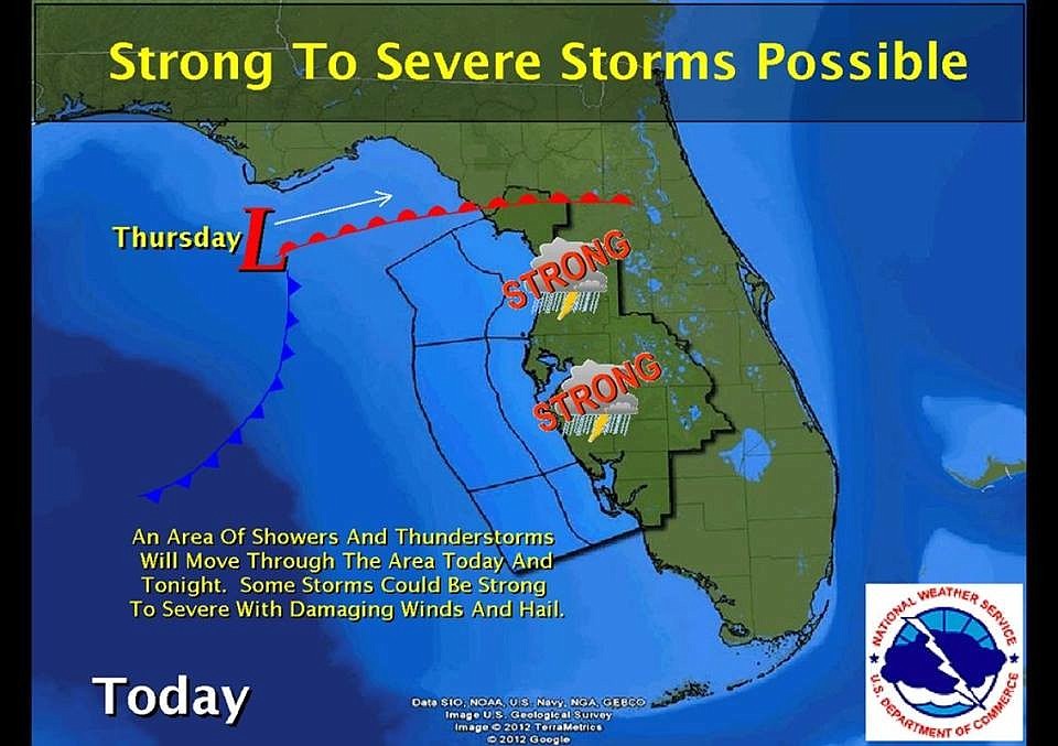
The National Weather Service predicts a frontal system forming in the eastern Gulf of Mexio will move through South Florida today, possibly producing some severe thunderstorms.
The storm system is anticipated to begin moving through the Sarasota County area Thursday around 10 a.m., and continue through the evening.
The storm system will bring the threat of locally heavy rainfall and flash flooding. A few thunderstorms may turn severe with damaging straight-line wind gusts and the possibility of isolated tornadoes.
Sarasota County Emergency Management advises area residents to drive with caution and monitor weather alerts for possible severe thunderstorm and tornado warnings and watches.
Contact Nolan Peterson at [email protected]