- June 19, 2026

-
-
Loading
Loading

Longboat Key leaders want to take action of their own to keep the distance between anchored vessels at a popular boating destination and the residents of the island’s north shore.
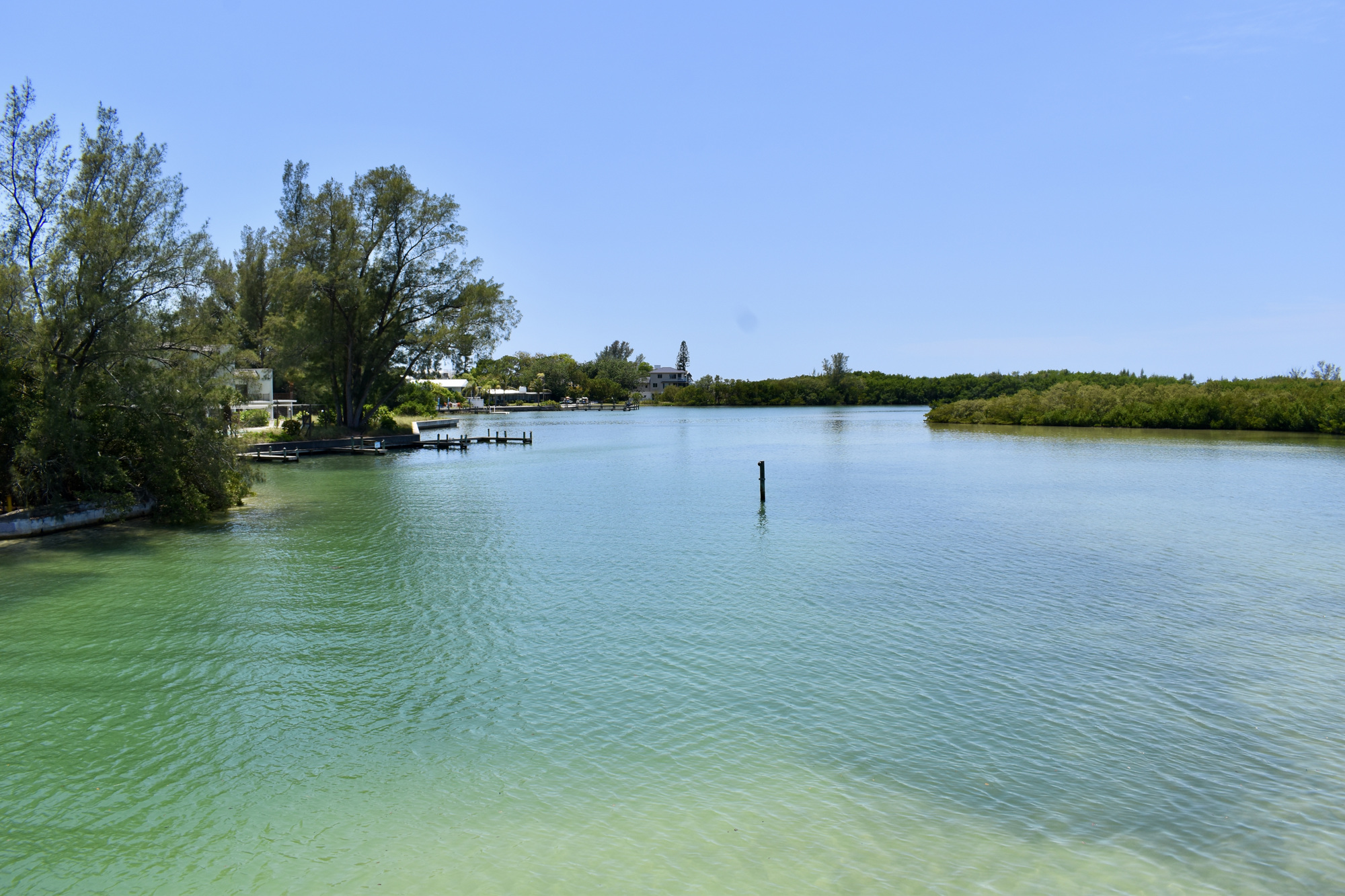
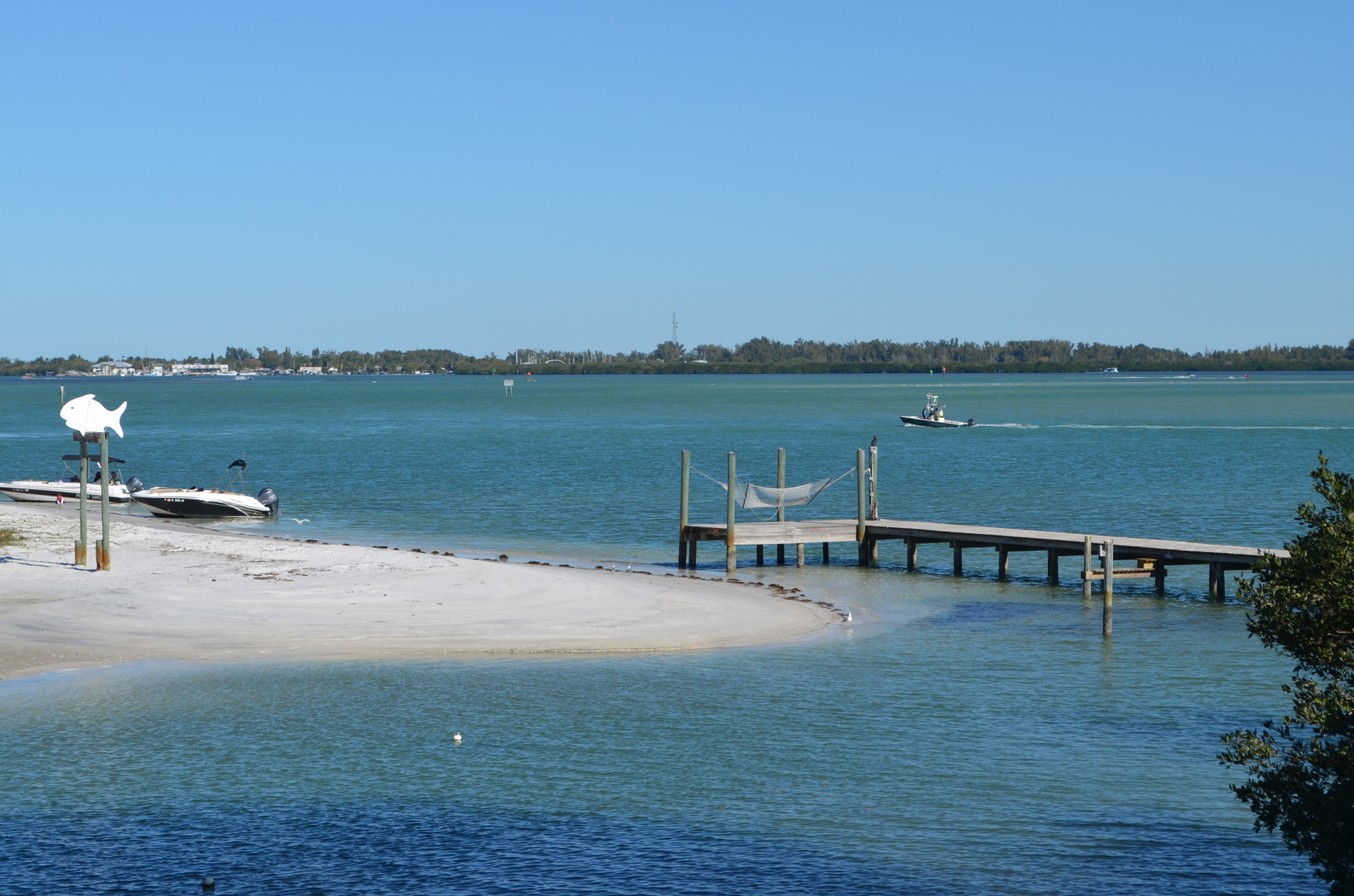
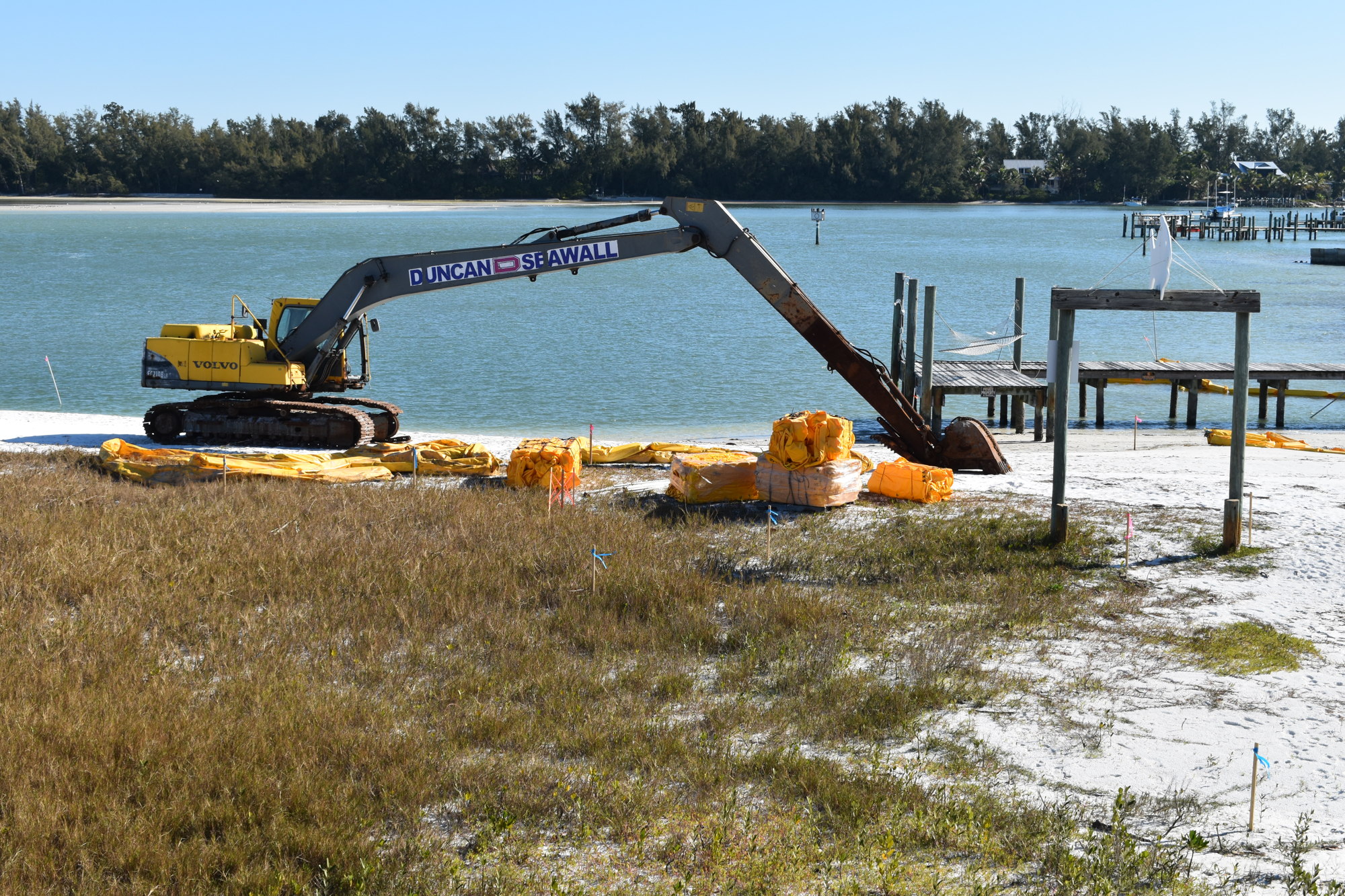
The wrap-around beach of Greer Island on weekends and holidays is regularly packed with small boats, beached on its east-facing side just south of the Longboat Pass boating channel. It’s one of the most dynamic geographic features in the area, shifting and growing as sand flows through the pass from the gulf side, though five groins built as part of the most recent beach management project are designed to slow that drift.
After an emergency project in early 2021 that pushed the waterline back north of the iconic wooden fish landmark, though, the fragile spit has again encroached on the decades-old Lands End dock, putting boaters ever-closer to private property and cutting off access to the Greer Island lagoon for all but kayaks, paddleboards, the smallest of boats and the occasional personal watercraft.
Manatees, too.
Mike Logan, who lives in the north end, said manatees that entered the lagoon in high water over the weekend had trouble getting out when the tide receded.
“The dock’s been there, 70 years probably," Vice Mayor Maureen Merrigan said. “What’s moved is the spit. My brother was a commercial fisherman and he was down a couple weeks ago and he said … ‘The only thing that changes here is (Greer) Island.'"
Although another emergency action to reopen the link to the lagoon to ensure tidal flushing for water quality and wildlife access is planned for June, a more comprehensive pushback of the sand might not happen until late in 2022. Such a spit management plan has been in the works for months, but would enable the town to periodically reset the sand to keep the outlet open, using the sand derived from the operation to put back on the nearby gulf beaches.
To keep boats from getting too close to north end property, owners of which have complained about noise and bad boater behavior, town staffers this week rolled out a plan for the Town Commission that proposed to designate a portion of the sand spit closest to the dock as a swimming beach zone, barring any motorized boats from entering a buoyed-off zone at least 50 feet, and up to 100 feet, into the water from the high-water mark.
The main zone would measure about 180 feet north and south, with the possibility of a smaller zone adjacent to Canal 1A that connects the lagoon to Sarasota Bay.
It’s not the first time town officials have tried to shoo boaters from the spot.
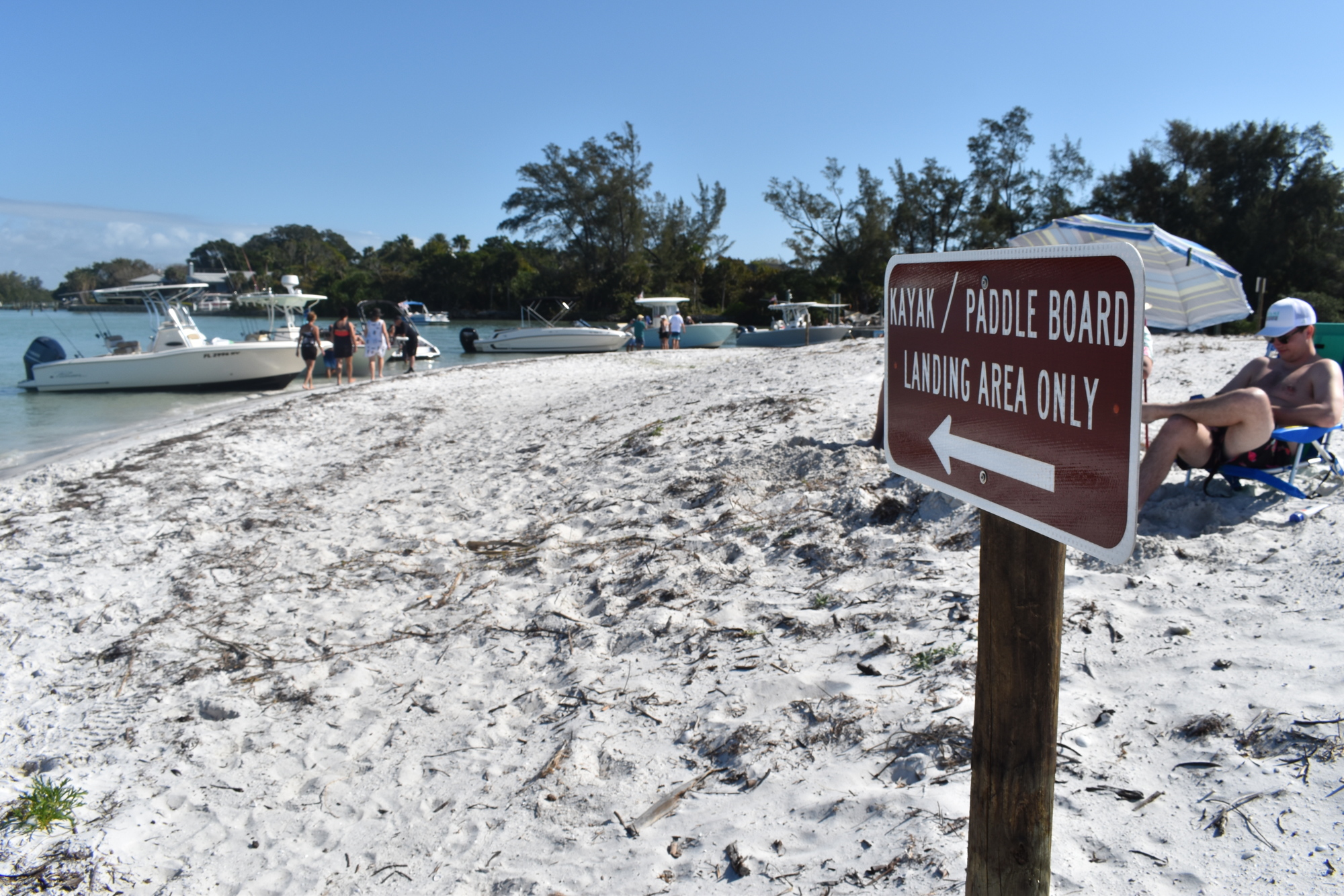
Earlier this year, in concert with Manatee County, signs were erected posting the area as reserved for the launch and recovery of non-motorized vessels only. About a month later, the signs were removed following word from Manatee County officials those restrictions couldn’t be enforced.
Even while the signs were up, boaters fairly routinely ignored them.
Although the bathing beach restrictions require review from the Florida Wildlife Conservation Commission, the town can create its own regulations. Other options such as simply banning motorboats, or calling for slow speed or no wake zones come with their own state requirements of data on accidents, injuries, damage and boating-infraction citations.
"Some of those are harder to get approved than others, so what you have is an effort by the staff to work with the state and identify a way we can generally accomplish what was being put in place before," Town Manager Tom Harmer said, adding town police can also cite boaters who anchor so close to the lagoon outlet as to impede navigation or anyone who might operate a powerboat in the lagoon unsafely or as a threat to wildlife or seagrass.
Town leaders earlier this year had hoped to designate the lagoon off-limits to all but the residents but found that state regulations require all to be treated equally.
"A local jurisdiction can establish a public beach or bathing area at the local jurisdiction’s own discretion, that’s why we’re recommending that, not necessarily that the anticipation is that this is going to be an active swimming area," said Allen Parsons, the town’s director of Planning, Zoning and Building.
Commissioners in the non-voting workshop session generally supported moving ahead with formalizing the proposal, hoping to vote on June 6 and July 1 to establish the swim-only zones by the Independence Day weekend.
Commissioner Mike Haycock said the presence of buoys bobbing in the waters off the Greer Island shoreline would be a strong indicator for boat operators to stay clear. Parsons said the state would require the swimming areas be marked.
"You’re going to see that way before you see the shoreline signs," he said. "I’ve rarely seen a boat violate an area that’s well marked."
Merrigan said once the lagoon opening is cleared out, she said she would be concerned that boaters will find a new place to beach, likely just east of the Longboat Pass bridge. Commissioners proposed adding a smaller, second swim zone there, just wide enough to border bump up against the boating channel, effectively blocking mooring or beaching. It would be against the rules to beach in the swim zone nor could they anchor in a channel, where they might block navigation.
Commissioners also discussed the potential in the future of simply allowing motorized vessels to come and go from docks behind homes on North Shore Drive.
Parsons said the town is already in communication with FWC on the plans and have heard no initial concerns or reasons to alter course.
Longboat’s proposed swimming zone is essentially the same as the area initially marked, then unmarked, by Manatee Count in March. The town has spoken with county leaders, who have urged them to maintain boating access east of the bridge’s main span, though the ever-shifting sand spit decades ago ended hundreds of yards to the west.
"We have the ability, if this doesn’t work, if people are avoiding it or it can’t be enforced or for some reason it doesn’t work, we can go back and say to Manatee County it doesn’t work and we have to extend it out to the bridge or something like that," said Mayor Ken Schneier.


