
- June 23, 2026

-
-
Loading
Loading
Like a fish out of water, something doesn’t quite fit where Canal 1A meets Sarasota Bay on the northern tip of Longboat Key.
Boats and kayaks, for starters.
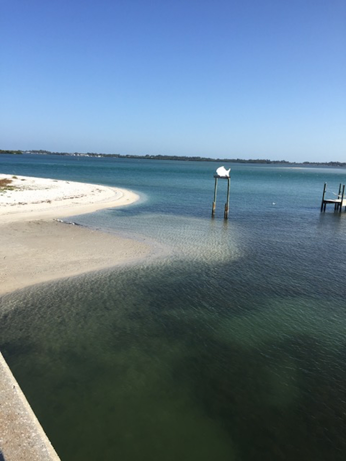
One of the most dynamic shoreline spots on the island, the eastern spit of Greer Island curls around and has been filling with sand for years – much of it coming from the gulf-facing beaches not far away.
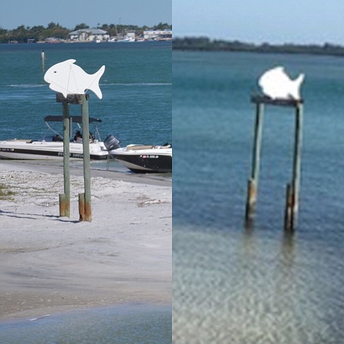
North end resident Maureen Merrigan said she recalls a fish-shaped wooden marker in the water for most of her 40-plus years of visiting Greer Island. James Linkogle, the town’s project manager for the Public Works Department, said he’s seen the marker surrounded by water in the 20-plus years he’s worked on the key.
Not so today.
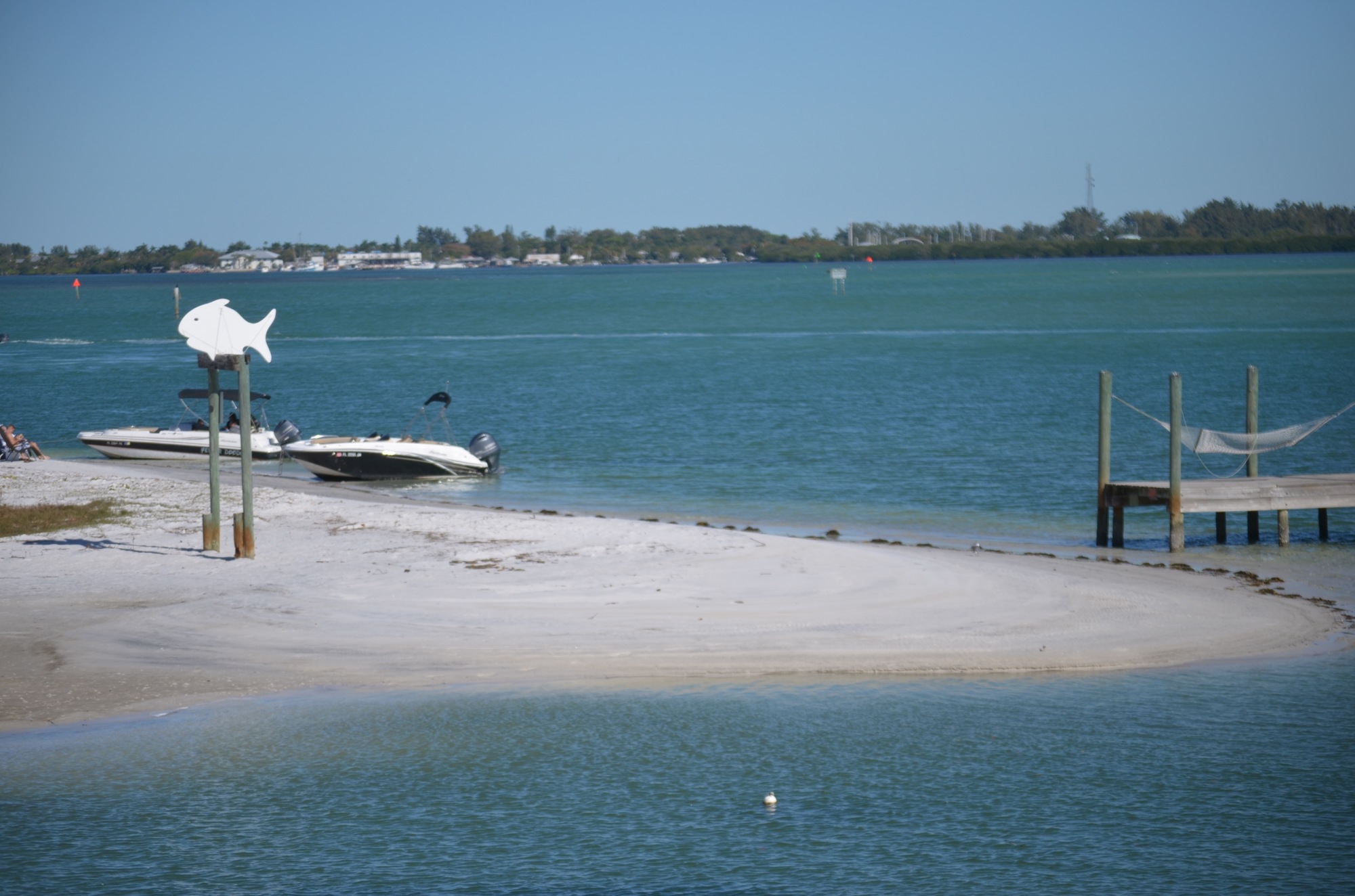
These days, the marker sits perhaps 20 yards from water’s edge. An adjacent pier nearly reaches out to the sand spit, cutting off access to Canal 1A under the Longboat Pass bridge and into the lagoon to the west.
“The spit has grown and has accelerated in growth so much to the point the sand is touching the dock and doesn’t allow for boat traffic,” said Charlie Mopps, a project manager with the town’s Public Works Department.
While the town considers when and how to pay for a general program to dredge canals townwide, which could cost upwards of $5.1 million, Canal 1A is in line for a fix as part of the town’s Comprehensive Beach Plan. A smaller emergency project to improve tidal flow and allow navigation again is also possible as a first step.
Mopps said depending on permitting possibilities with the U.S. Army Corps of Engineers, a small project could launch within months to deepen Canal 1A and shave some of the eastern-most edge off Greer Island's sandbar. That project would be followed up with a larger project designed to clear most of the sand east of the bridge and save that sand to backfill the town’s groins when they are constructed as part of the beach plan. Between 15,000 and 25,000 cubic yards ultimately could be removed, pushing the water much closer to the bridge itself. But, federal authorities first half to sign off.
“I cant put a shovel without a permit,’’ Mopps said.
The price estimate for the overall project ranges from $750,000 to just over $1 million, with that money readily available from the town’s beach fund. Commissioner Ken Schneier said the situation at Canal 1A is “an urgent situation if not a crisis situation.’’
Concerns over the lagoon becoming cut off from tidal flow and stagnating also are top of mind of Vice Mayor Ed Zunz.
“The people at that end are entirely frustrated," he said.
Mopps said the groin project ultimately would lock the sand in on the gulf side and keep it from flowing through Longboat Pass and re-creating the Canal 1A problem.
“This is the unicorn, where you have material that both goes north and south, that’s why we get that spit growth,’’ he said. “Because sand isn’t going to the south, it’s going to the north at that nodal point.’’
The town has already had conversations with state and federal agencies and is moving ahead toward permitting the overall project while also readying an emergency plan with its contractors should approval be given.


