- April 27, 2024

-
-
Loading
Loading
As hurricane season creeps up on the area, the Climate Adaptation Center has a forecast of what kinds of storms may be headed this way.
The organization hosted a Zoom conference April 4 to give viewers an idea of what they can expect from this season.
Climate Adaptation Center CEO Bob Bunting gave the presentation and his forecast for the 2023 hurricane season.
“This year we have an improving situation from a hurricane standpoint,” he said.
The beginning of the season could be tumultuous becoming more favorable toward peak season.
Components of Bunting’s forecast included:
Early May is when Bunting says the area can start to see an increase in storms. Peak season is expected for early September.
“Between the 10th and 30th of October is a very serious time here in Sarasota,” he said. “Don’t be fooled that once we pass the peak, we’re out of the woods, our worst times this year could be very early in the season and then in October again.”
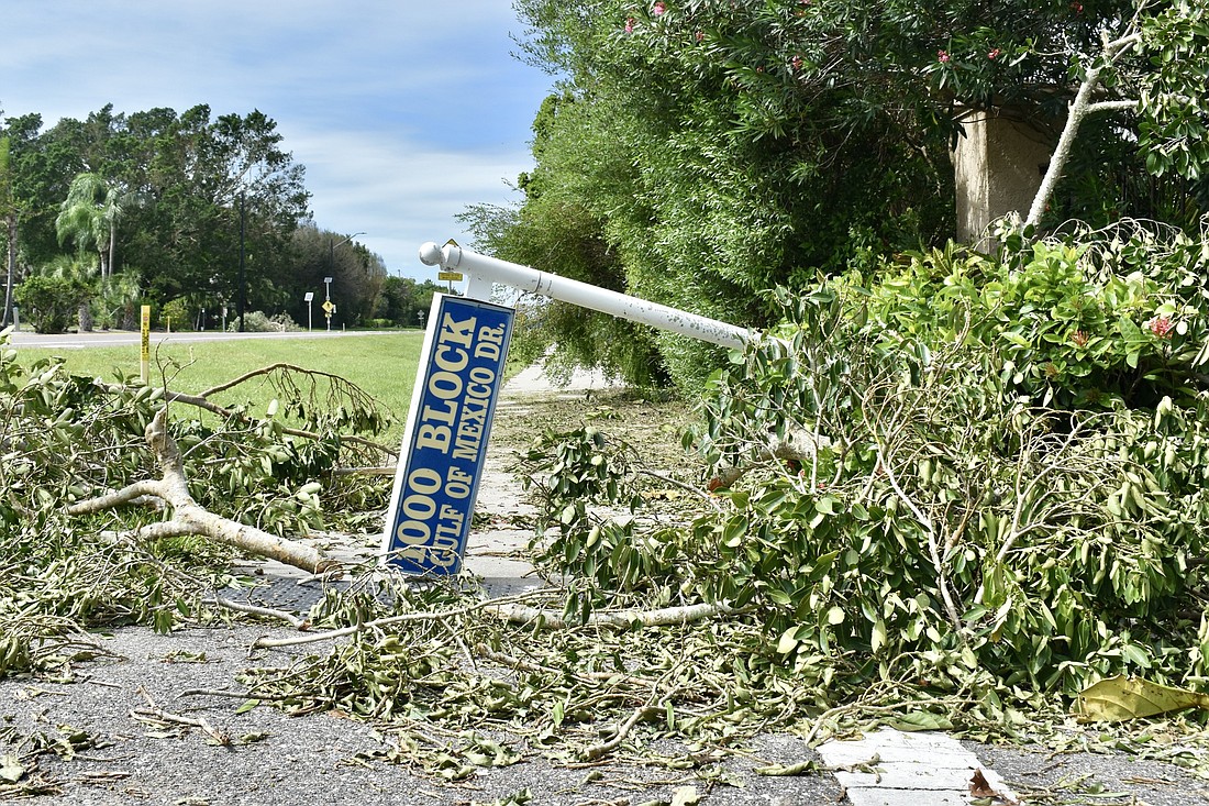
In November 2021, Bunting predicted a hurricane of Ian’s size and level of destruction.
“Florida was setting itself up for a major hurricane strike,” he said.
When developing an early season forecast, Bunting examines a number of factors including sea surface temperatures, whether conditions are La Nina or El Nino and the Madden-Julian Oscillation once the season kicks off. The Madden-Julian Oscillation is an eastward moving disturbance of clouds, rainfall, winds and pressure that traverses the planet in the tropics and returns to its initial starting point in 30 to 60 days, according to the National Oceanic and Atmospheric Association.
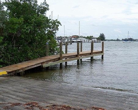
As a hurricane approaches, Bunting says it is important to understand how the spin of the hurricane amplifies storm surge.
On the north side of the eye, the wind blows from the shoreline out to the ocean. There won’t be a storm surge in that area.
On the south side of the eye, the spin is coming on shore and the hurricane force winds are blowing water onto the shore, amplifying storm surge.
Another important consideration Bunting gave to viewers was that sea levels have risen 9 inches since 1950.
“A hurricane that would strike us in 1950 at the same size, the same intensity and moving the same speed is gong to do a lot more damage because we have way more population than we did in 1950 and the sea level has already risen 9 inches,” he said. “If your elevation where your home is located was 5 feet above sea level in 1950, now it’s only 4 feet. That means you have less buffer protecting you from the impacts of storm surges.”
He further urged the importance of knowing your elevation because it can help in deciding to evacuate and when to leave.
Bunting asked any government officials watching his presentation to consider looking into raising roads in their areas. Raising roads is especially important as sea levels rise, he said. As sea levels rise, the window for evacuation shrinks because roads run the risk of flooding, making evacuation difficult or impossible. Even raising roads an additional 1 to 3 feet can add an additional eight to 10 hours to the window available to evacuate, Bunting said.
Category 2 storms, which are more frequent compared to major hurricanes, can still cause serious damage. Under certain conditions, storm surges can reach as high as 9 feet on barrier islands like Longboat Key — even without the presence of a major hurricane classification.