- April 25, 2024

-
-
Loading
Loading
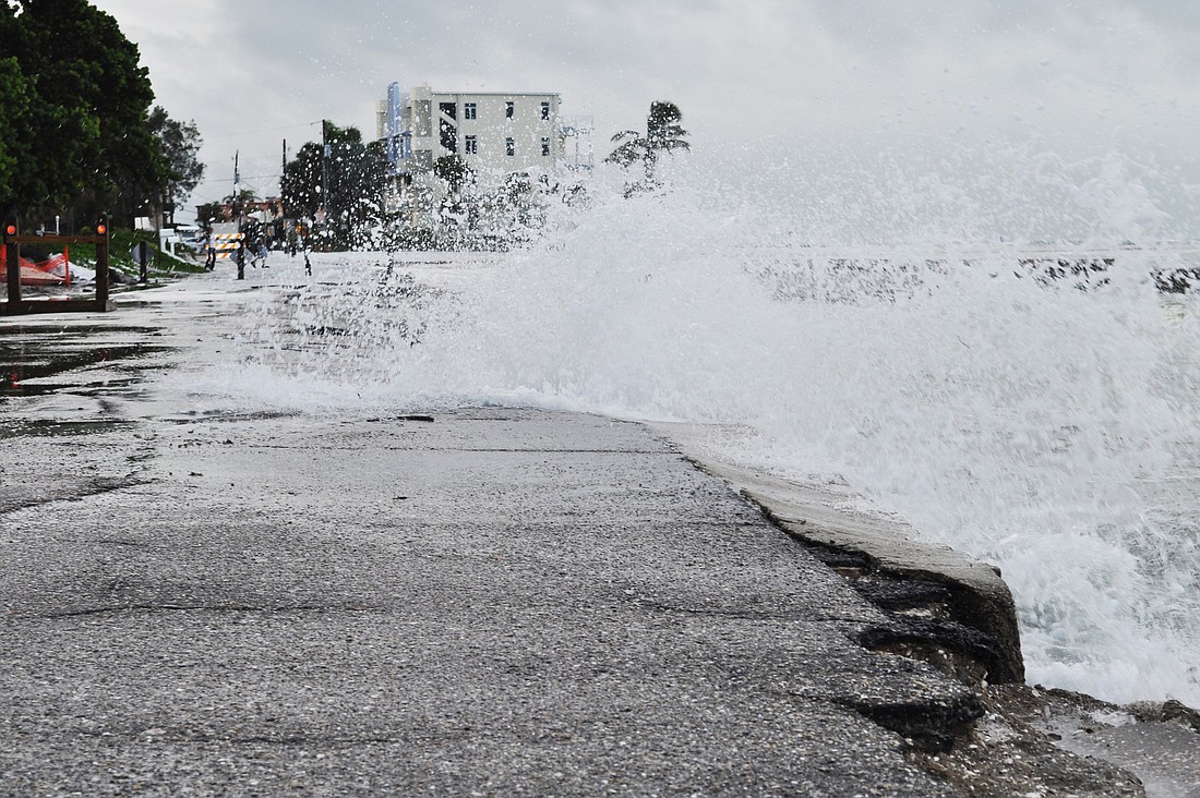
While Tropical Storm Isaac no longer poses a direct threat to Southwest Florida, officials are warning residents to stay vigilant today as storm squalls, gusts of wind, rip currents and flooding are likely as the storm churns through the Gulf of Mexico on its way to the Louisiana coastline.
High winds and heavy rain are expected to begin late this morning or early this afternoon, and rough surf with anticipated wave heights of 6 to 8-feet will result in dangerous rip currents as the storm passes.
Flooding, tornadoes and other weather changes can develop as Isaac moves across the Gulf of Mexico.
The area will start to see the effects of the storm subside this evening. Government offices and schools, meanwhile, are expected to re-open Tuesday.
Storm Tips
• Sarasota County has closed the evacuation shelter at Woodland Middle School, 2700 Panacea Blvd., in North Port this morning. The evacuation shelters at Heron Creek Middle School, 6501 W. Price Blvd. in North Port and Brookside Middle School, 3636 S. Shade Ave. in Sarasota remain open.
• Drivers should avoid flooded areas. If traffic lights aren't working, treat intersections as four-way stops.
• People are urged to stay off roads after the storm subsides to give emergency workers time to respond to any problems. Flooded streets can cover downed power lines.
• Children shouldn't be permitted to play in flooded areas, which may contain snakes and fire ants, as well as bacteria.
• Residents using generators for emergency power should use them outside or in well-ventilated areas. Generators should be turned off during refueling.
• Residents are urged to use battery-powered lanterns or flashlights for illumination instead of candles during any power outages to avoid fire hazards.
• To report a power outage or downed power lines, call 1-800-468-8243.