- April 25, 2024

-
-
Loading
Loading
Update (9 p.m.): Sarasota County says no trash collection until at least Wednesday. Officials urge residents to refrain from putting trash and recycling containers at the curb to ease debris removal.
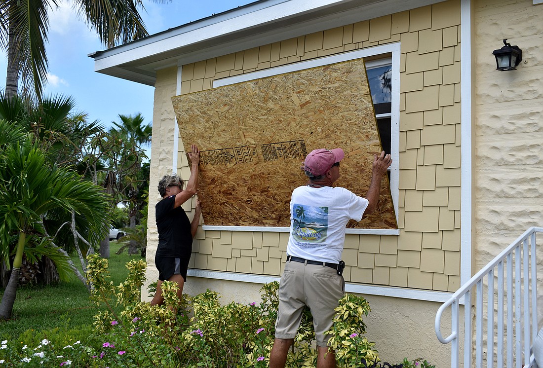
With tropical storm force winds expected to start at noon Sunday, Sarasota County residents are advised to “shelter in place” at this time.
Five of Sarasota County’s shelters reached capacity on Saturday, leaving five open with about 7,000 spaces left. At this time, the area is starting to feel the affects of Hurricane Irma, which made landfall in the Florida Keys Saturday morning. The storm is expected to be at its height in Sarasota within the next 24 hours. Emergency officials are advising people to go to shelters now and not wait if they’re considering it.
According to meteorologist Stephen Shiveley with the National Weather Service, Sarasota County can expect peak winds Sunday night, between 9 p.m. to midnight. Those winds could be upward of 85 mph, with gusts of up to 110 mph.
Tropical storm force winds, which are anything above 35 mph, are expected from noon Sunday to 9 a.m. Monday, when the storm will have moved past the county.
As for rain, the estimate is up to 10-15 inches for the county. Previously, officials were predicting 6-10 inches of rain.
Areas that flooded during the rain that hit Sarasota County two weekends ago may flood again, McCrane said. “It’s definitely going to be a major hurricane.”
Despite a mandatory evacuation order issued on Friday for barrier islands, some Longboat Key residents are staying put.
Longboat Key Fire and Rescue Chief Paul Dezzi said the department did a sweep of the island Sunday morning to talk to some residents who were still present.
“We’ve talked to many of them, and they just feel they can ride out the storm, which is not something we recommend to them, and they are aware that once winds reach 45 mph, we can’t reach them,” Dezzi said.
People were ordered to evacuate by 8 p.m. on Saturday, but Dezzi advises people to leave before noon Sunday, which is when the fire department will be leaving. To ensure no one returns to the island, Longboat Key police officers are posted at both ends of the Key. Police Chief Pete Cumming said officers will be monitoring both ends until there are sustained winds of 45 mph.
The Longboat Key Public Works Department, police and fire departments are preparing for the aftermath. The departments will be getting bulldozers from Sarasota Memorial Hospital to clear debris. Dezzi said they are expecting there to be damage to structures, flooding and roads to be blocked.
“We’re expecting the worst, of course,” Dezzi said. “We’re expecting heavy flooding with probably a storm surge of 8 to 10 feet, and so the reason we came back this morning was to raise some things off the floor.”
The fire rescue and public works and police departments will be conducting search and rescue following the storm to help anyone who may need assistance on the Key.
In preparation for the storm, Sarasota County deployed tactical teams made up of police and Sheriff’s deputies, fire department employees, first responders and public works employees Saturday night to find shelter in different parts of the county and wait out the storm. Then, when the danger has passed, the teams will go out and begin clearing critical roadways just enough that emergency and essential vehicles can pass through.
McCrane asked that residents not immediately leave their shelters after the storm. First, it’s important to be sure that the storm has actually passed before leaving. The eye of the storm could be over Sarasota and conditions could improve, but that means the hurricane is only halfway over.
It’s possible tornadoes will form in the area after the storm. McCrane advised residents to continue to monitor their phone for weather updates. He also asked residents to be cautious about debris and standing water in the aftermath of the storm.
“Keep in mind this storm is going to be very destructive,” McCrane said. “Weaker structures made out of wood and thousands of nails will be destroyed.”
Emergency personnel also have to inspect bridges and go house by house along the barrier islands to see if they need to rescue anyone who didn’t evacuate. They will also be checking infrastructure on the islands before letting business owners and residents back on. They will need to show some type of ID to get back onto the island before the area is reopened to the general public.
“We are going to be overwhelmed, and the state of Florida knows that,” McCrane said, explaining the state government has positioned resources around Florida, like food and water, which will be shipped in as soon as conditions permit.
Emergency officials urge people to stay put until an all-clear has been issued after the storm. McCrane encouraged residents to have a battery-powered radio available to follow local media for information during and after the storm. People can also find updates from media and the county online and on social media.
“Afterwards, we’re going to have a lot of lessons learned on how to do it better next time,” McCrane said.