
- July 28, 2026

-
-
Loading
Loading
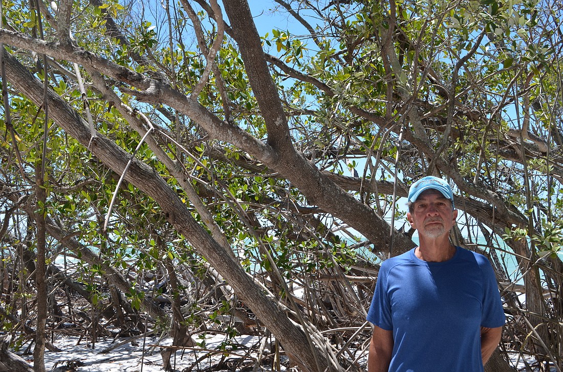
On a Friday afternoon on Greer Island, also known as Beer Can Island, Bob Bunting is surrounded by mangroves — many of which look like sticks in the ground, barren of leaves or other signs of life.
Bunting, a former National Oceanic and Atmospheric Administration official, affirms these mangroves are dead, or at least suffering.
While mangroves remain dense and flourishing in much of the area on and surrounding Greer Island, the sliver of land that connects the “island” to Longboat Key, it is also home to many dead or dying mangroves.
Bunting, who lives nearby at 360 North, said erosion is to blame for the declining health of the plants.
Bunting explained that the mangroves thrive in brackish water from the Gulf of Mexico and Sarasota Bay, but too much saltwater can harm them.
As this sliver of land has overwashed with increasing frequency, the number of dead mangroves has increased, Bunting said, adding that he recalls significant portions of the mangroves still flourishing on the sliver in June 2016.
Bunting noted the roots and foliage of the mangroves, when healthy, help protect the mainland from storm surges. They also serve as a habitat for animals and birds.
“It is an incredibly environmentally sensitive area,” Bunting said. “And it plays a huge role in protecting the shore.”
The sliver containing the diminishing mangroves is also the area Bunting said is most susceptible to a breach.
If a breach happens, Bunting said saltwater and sand would pour into the lagoon, throwing off the delicate balance of the lagoon’s water.
It would also subject residences on the lagoon to wave action.
Should the mangrove forests die, Bunting theorized it could take more than 50 years for the plants to grow back to their current form and density.
A breach of Greer Island is a potential outcome being examined in the North End Shoreline Stabilization Project.
In March, the Town Commission approved a $400,000 budget for the plan.
The funds, left over from previous construction projects in the beach budget, will be used to determine the feasibility of an immediate short-term solution, as well as developing a long-term plan for the area. In this case, “long-term” means decades or longer.
Town staff will work with Olsen Associates Inc., the Key’s coastal engineer, to determine possible courses of action, then present the options to the Town Commission for consideration in the coming months.
When it comes to long-term solutions, Bunting has advocated for a third groin at the northern tip of the Key to accompany the two groins already on the north end.
While a third groin was initially proposed with the two near North Shore Road, the prospect was delayed after Manatee County challenged the plan.
In a 2014 settlement, the town agreed not to begin permitting for the third groin until 2019, in return for construction of the other two.
“I would be shocked if a groin wasn’t the answer,” Bunting said.
Pat Zunz of resident group LBK North, of which Bunting is a member, has encouraged members to attend the Town Commission workshop meeting on Monday, April 17 to discuss options for the North End Shoreline Stabilization Project.
Bunting said people like himself, who regularly enjoy Greer Island, have a duty to maintain it.
“It’s our responsibility to leave it in good shape for the future,” Bunting said.


