- April 19, 2024

-
-
Loading
Loading
This story was updated at 5:45 p.m.
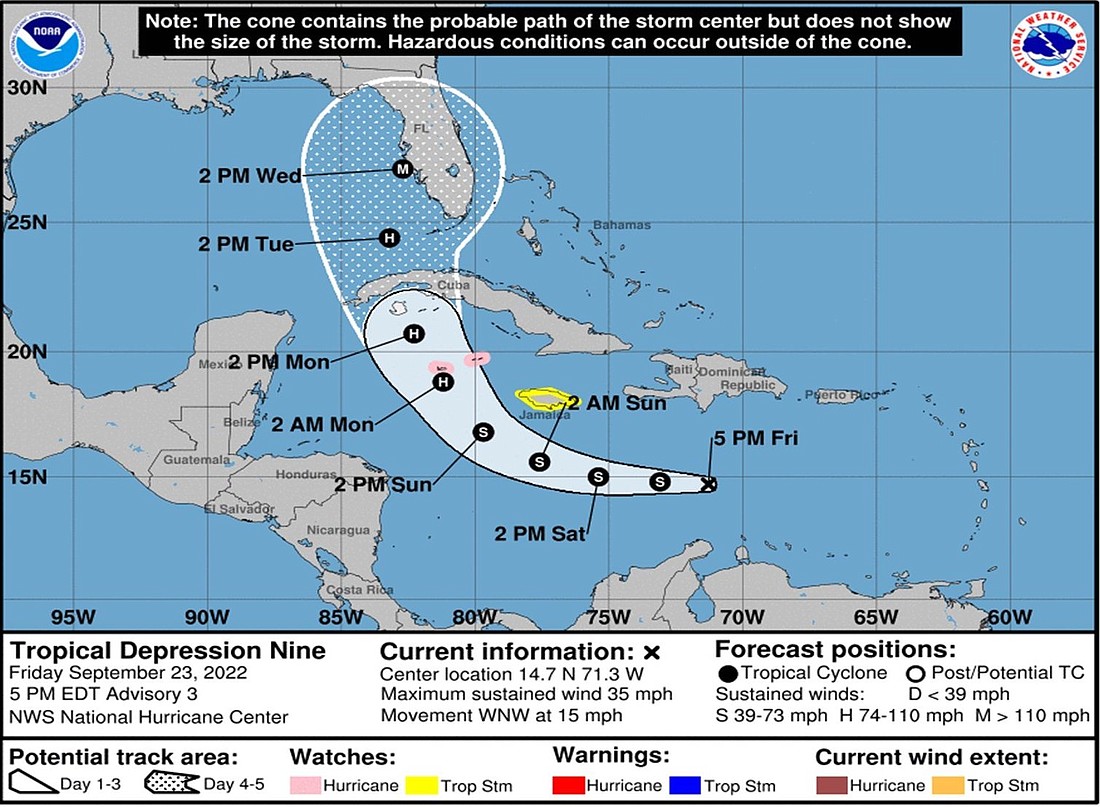
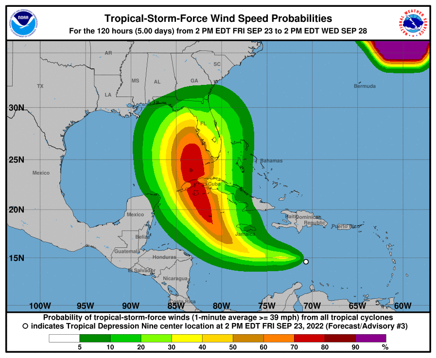
Longboat Key officials are keeping an eye on a gathering storm called Tropical Depression 9 in the Caribbean Sea, advising residents to stay informed throughout the weekend on what could become Tropical Storm Ian by Saturday.
Fire Chief Paul Dezzi, in a message to town residents, said his department has recommended to town departments and residents that they begin reviewing tropical weather plans. “I would ask property managers to encourage staff to become familiar with your plan(s) in the event the track of the storm causes concern,’’ he wrote.
The storm, which rose to tropical depression status Friday morning with winds of 35 mph, was located north of Venezuela and heading generally west, with a turn toward the northwest and north forecast by Monday morning.
According to the National Hurricane Center, the storm is expected to reach the southern coast of Cuba as a hurricane by 2 a.m. Tuesday and approach the southwest Florida coast 24 hours later. Tropical Storm Hermine flared up in the eastern Atlantic on Friday, though expected to downgrade again after drenching the Azores.
No warnings or watches are posted, though Gov. Ron DeSantis late Friday placed 24 counties in the southern tier of Florida's peninsula in a state of emergency. Sarasota and Manatee counties are included in that list.
“Today, I signed an Executive Order issuing a State of Emergency due to the threat of Tropical Depression 9,” DeSantis said. “This storm has the potential to strengthen into a major hurricane and we encourage all Floridians to make their preparations. We are coordinating with all state and local government partners to track potential impacts of this storm.”
Dezzi said the town is watching several forecast models and is in communication with county and state emergency managers, in addition to the National Weather Service.
“We will provide direction if the need arises and even consider a conference call. Just understand that we are monitoring and will communicate with you if the storm track dictates such. Better prepare early than too late.’’
Longboat Key Town Manager Tom Harmer told town staffers and commissioners the town is closely monitoring the storm’s developments.
Read more: Sandbag stations open on Sunday
“Based on current forecasts it could influence our weather by mid-week next week,’’ he wrote. “As it moves into the northwest Caribbean conditions are favorable for strengthening to a hurricane. But, at this time, there is still some considerable uncertainty to track especially as we look out over the next week.’’
Both Sarasota County and Manatee County emergency managers posted statements Friday.
"As the path and intensity of the depression remain uncertain, all of Sarasota County is encouraged to review their emergency preparedness plans in the event the storm will have an impact on our community,'' Sarasota County Government Emergency Services said in a social media post.