- April 19, 2024

-
-
Loading
Loading
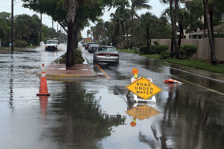
The new Florida Emergency Management Agency floodplain maps could affect insurance and construction costs for thousands of Sarasota County property owners next year. This week, homeowners real estate professionals will get the chance to speak with FEMA representatives one-on-one about the changes.
Beginning this afternoon, the county and FEMA will host three open houses this week, and several more in the following months to discuss the new maps, in which 40,000 parcels have been shifted in or out of high-risk flood zones. Each workshop will last for roughly three hours.
FEMA, the county and the Southwest Regional Water Management District released the new maps based on more accurate data and analysis, according to a FEMA news release. Federal-insured mortgage lenders require flood insurance for those in “high risk” areas, and building codes vary based on location within a map.
Click here for a tutorial on how to find your property on the FEMA draft floodplain map.
IF YOU GO
What: FEMA floodplain map workshop
When: 4 p.m. Tuesday, Jan. 20
Where: Sarasota Community Bayfront Center, 803 N. Tamiami Trail, Sarasota
What: FEMA floodplain map workshop
When: 4 p.m. Wednesday, Jan. 21
Where: Venice Community Center, 326 Nokomis Ave., Venice
What: FEMA floodplain map workshop
When: 4 p.m. Thursday, Jan. 22
Where: Morgan Family Community Center, 6207 W. Price Blvd., North Port