- April 19, 2024

-
-
Loading
Loading
On a recent blustery Sunday, Bob Bunting headed out on the north end of Longboat Key to walk to the beach. There was one problem: It wasn’t there.
“When I got down to the beach, I thought I misread the tide table and said, ‘I must have gotten this backwards’, ” he said.
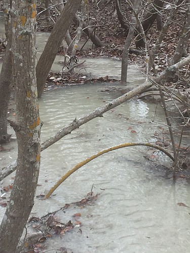
So, the former National Oceanic and Atmospheric Administration official and current 360 North resident walked along a winding path through Beer Can Island at the tip of the Key and had one of his worst fears confirmed: Saltwater from the Gulf of Mexico had washed over the island, and was flowing steadily into the cove.
“Basically, I was up to my knees in water at low tide there,” Bunting said.
The incident, which occurred Jan. 22 as strong winds from the north and west pushed through Sarasota and Manatee counties, came less than a week after he spoke at a forum hosted by citizens group LBK North about the possibility of Beer Can Island breaching, which could threaten homes and condominiums on the north end.
“I think we should all be concerned about this ‘washover’ situation gradually moving toward a permanent breach,” Bunting said, speaking during an emergency meeting of LBK North stakeholders and Longboat leaders on Jan. 18. “The probability I would say is extremely high.”
After the meeting of a dozen people in the conference room of the Longbeach Condominium Association, which included Public Works Director Juan Florensa and Town Commissioner Ed Zunz, the group trudged along the beach and through Beer Can Island to assess the situation. Walking a path lined with dead mullet from recent red tide blooms and a labyrinth of dead mangrove root systems, Bunting pointed to two paths that water from the gulf cleared into the cove.
Florensa referred to the Jan. 22 washover as a mini-storm surge, which happens when storms with strong northwestern winds hit the island, and noted similar incidents have happened over the past decade during similar storms or larger tropical systems. Though it has happened infrequently in the past, this incident was of a greater magnitude than is typical.
“That thing was pretty angry for about three or four days non-stop,” he said. “It lingered here longer than usual.”
But, the situation at Beer Can Island is complicated, and the land mass has shifted around so much over the past century, Town Manager Dave Bullock always refers to its current state as ephemeral. Solutions for how to stabilize it are just as difficult to pin down — and implement.
Before 2014, the town had planned to build a terminal groin on the north tip of the island, but a challenge from environmental groups forced Longboat to re-evaluate the proposal and settle for two adjustable groins in front of 360 North and Longbeach as part of a $2.4 million project that wrapped up at the end of 2015. As part of the settlement of the challenge, the town can’t apply for a Florida Department of Environmental Protection permit for a permanent groin on Beer Can Island until 2019.
Models developed during that project by GEI Consulting Engineers and Scientists (Coastal Planning & Engineering at the time) indicated that without that terminal groin, there would be the type of degradation currently happening on Beer Can.
“Basically the area is acting much like we expected it to act,” Bullock said. “It’ll be interesting to see if the dune just keeps moving farther and farther into the lagoon.”
Florensa said the town’s current consultant, Olsen Associates, would look into options for stabilizing Beer Can, including traditional structures, such as groins, jetties and breakwaters. The town and Olsen are writing up a scope of work for that analysis.
Maureen Merrigan, another north end resident, has been lobbying for the town to dredge sand from the east side of the cove, which has nearly enclosed the body of water, and pump it in front of Beer Can Island. But the town would have to prove to state and federal officials that the targeted sand has the color and grain size to make it “beach compatible.”
Further, the sand could just be swept away through erosion or during the next big storm.
“It’s just like throwing dollar bills in the water,” Florensa said.
Among other options are adjusting the two permeable groins to allow more sand flow, but that would leave the beaches in front of 360 North and Longbeach vulnerable to further erosion. The town may also look to alternatives technologies, such as reef balls or Sandsavers, both of which are portable concrete shapes that are designed to break wave actions.
Olsen will speak before the Town Commission in March or April, and although the company likely won’t have solutions mapped out, it can update commissioners on its progress and take any new input on objectives for Beer Can Island.
“It’s not a simple problem, and it’s not going to have a simple solution,” said Olsen Vice President and Senior Engineer Al Browder.
But Florensa said he wants to assure residents the town is moving forward as quickly as it can with fixes.
“The word is out,” he said. “And residents are being heard.”