- April 18, 2024

-
-
Loading
Loading
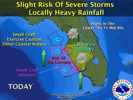
Severe thunderstorms are forecast for the Sarasota County area beginning this afternoon and lasting into the evening, according to the National Weather Service.
Forecasters are predicting damaging winds, heavy rainfall and isolated tornadoes.
According to Sarasota County Emergency Management, the storms’ local impacts will include:
• The risk for rip currents at area beaches will remain elevated through Monday evening.
• Strong to severe thunderstorms (mainly late Monday morning into Monday evening).
• Damaging wind gusts will be possible with the strongest storms.
• Isolated tornadoes or marine waterspouts will be possible.
• Small hail will be possible with the strongest storms.
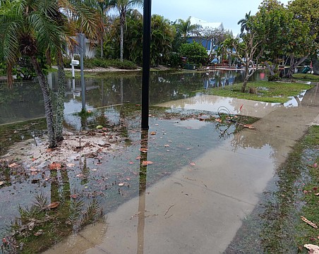
• Heavy rainfall amounts of up to two to three inches will be possible across the Nature Coast, with up to two inches from the Tampa Bay area southward. These amounts could result in localized ponding of water on roadways.
Sarasota County Emergency Management advises area residents to drive with caution and monitor weather alerts for possible severe thunderstorm and tornado warnings and watches.
Contact Nolan Peterson at [email protected]