- April 24, 2024

-
-
Loading
Loading
Technology is only one piece of the Florida Department of Transportation’s Sarasota-Manatee Barrier Islands Traffic Study.
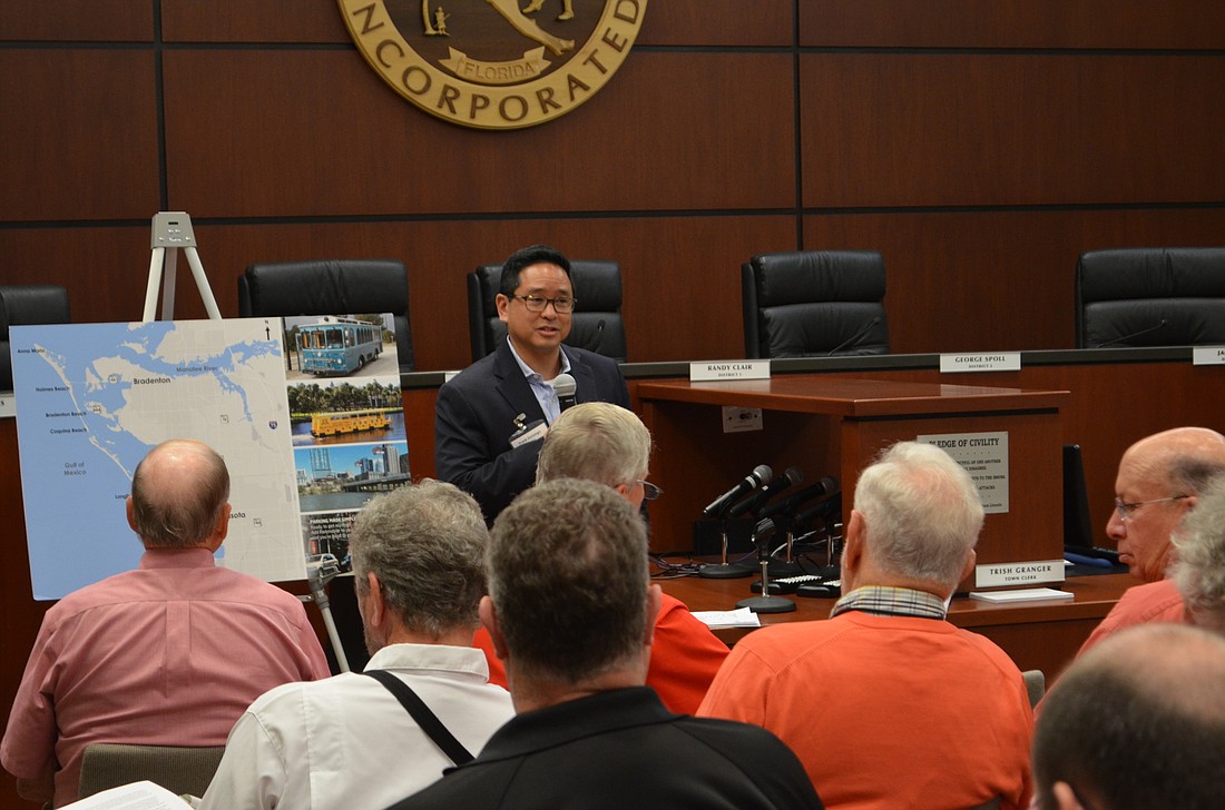
But, according to the project manager of FDOT’s consulting company, it’s the most powerful.
“Knowledge is power,” Frank Domingo said Tuesday, launching the early stages of the long-awaited look at traffic, how it flows and how to improve it from the south end of Lido Key, through Longboat Key to the northern tip of Anna Maria Island.
“Better use of technology is absolutely key,’’ he said.
In its examination of traffic patterns, along with access to the islands along State Road 64, Cortez Road and the John Ringling Parkway, Domingo said FDOT will use “origin-destination data” from Bluetooth-enabled devices, like cellphones and laptop computers, to analyze where people are coming from, where they are going, how long they are staying and more. Siesta Key is not included.
“This is a newer technology that allows you to set better trends and get really usable data,” Domingo said, speaking before about 50 people at the first steering committee meeting for the study, which was held Tuesday at Longboat Key Town Hall.
The study will also assess public transit services, event operations, and the needs of pedestrians and bicyclists, Domingo said.
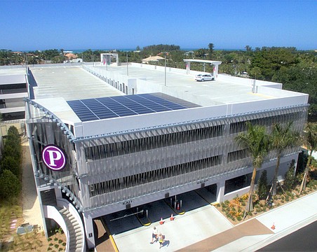
Parking-related solutions to traffic problems also will be explored, Domingo said, mentioning the possibility of “Park-N-Ride” locations, allowing motorists to park on the mainland and shuttle to the islands. He also discussed the possibility of using a combination of parking sensors and smartphone apps to alert drivers when parking on the islands is unavailable.
Traffic on Longboat Key and the other barrier islands is a perennial gripe of residents and government leaders alike to the point of spawning ideas generated by residents, such as those on the Longboat Key Revitalization Task Force.
Some small victories have taken place, such as traffic-light timing changes on the mainland and a focus on keeping intersections clear.
At least four previous traffic studies have been done since 2005, looking at a variety of issues.
Tom Freiwald, the Revitalization Task Force chairman, said the most important aspect of the new study is making sure recommendations will be implemented.
“That always seems to be the weakness of past traffic studies,” he said. “We never seem to get to the point of implementation.”
Freiwald said he hopes the study’s steering committee will assign responsibility and accountability for changes.
“Only then will the study be worthwhile,” he said. “Without that, it will just be another study.”
Longboat Key Town Manager Dave Bullock has long been a proponent of the new FDOT study, and said he’s enthusiastic about its start.
“Let’s get it going,” he said.
The FDOT study of barrier island traffic is designed in three parts, with the ultimate goal of specific recommendations by fall 2018. Data from the 2018 winter-visitor season will be captured and factored into the final report.
The three phases of the study:
Phase 1: Review of available studies and transportation plans regarding the barrier islands to compile a summary of recommendations. Domingo said many of these previous efforts are still relevant.
Phase 2: Make observations and collect traffic data.
Phase 3: Complete a transportation management plan and recommend improvements.
Public meetings and involvement will be a major portion of the study, Domingo said. He added that FDOT expects to complete Phase 1 by the end of this summer.
FDOT officials expect the study to cost $675,000. In September 2016, the state approved funding 80% of the study, while the MPO will cover the remaining 20%.
PREVIOUS STUDIES
Traffic on and around Longboat Key has been the subject of studies for decades. Here is a sample:
• “Longboat Key Bridge Analysis Status Report,” 10 pages, prepared in 1980 by the Sarasota-Bradenton Metropolitan Planning Organization, referencing a 1973 FDOT feasibility study and discussions in the late 1970s. Suggestion: Build a bridge over Sarasota Bay at roughly mid-Longboat Key. Cost estimated then at $40 million.
• “Transportation Analysis for an Additional Bridge to Longboat Key,” prepared in 1991 by the Sarasota/Manatee MPO. Recommended: New bridges to Longboat Key are not warranted. Upgrade turn lanes and traffic signals at intersection of Gulf of Mexico Drive and Longboat Club Drive.
• “Water Taxi Feasibility Study,” 31 pages, prepared in 2005 by Renaissance Planning Group for the Sarasota/Manatee MPO. Recommended: Begin pilot water taxi service in Sarasota, with connections between the downtown area, Longboat Key, Mote Marine Laboratory and possibly Siesta Key at a cost of $2 million for a system of three routes and seven vessels operating seven days a week for 12 hours a day.
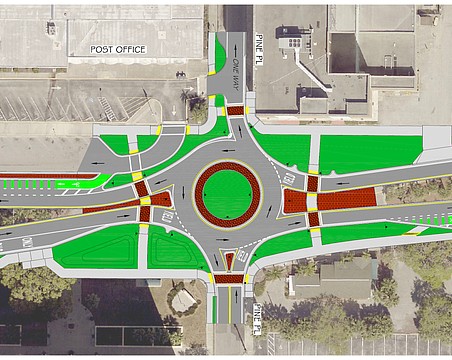
• “Development of Effective Strategies to Alleviate Traffic Congestion for the Barrier Islands,” 86 pages, prepared in 2007 by the Center for Urban Transportation Research for the Town of Longboat Key, with funding assistance from Sarasota County and Manatee County. Recommended: Alleviate traffic congestion at St. Armands Circle by establishing North Adams Drive and Madison Drive as an alternate route. Ease traffic congestion near the Gulf Drive and Cortez Road intersection by increasing northbound capacity of the mini-roundabout on Gulf Drive at Bridge Street.
• “Mobility 2035, Long-Range Transportation Plan,” 241 pages, prepared in 2010 by Renaissance Planning Group for the Sarasota/Manatee MPO. Amended in January 2014. Cost: Estimated, $275,000. Recommended: Strategic direction for how MPO, member agencies and partners will achieve mobility and accessibility goals over 25 years. Prioritizes transportation projects and costs.
• “Regional Park-and-Ride Strategic Implementation Plan,” 142 pages, prepared in 2013 by Renaissance Planning Group for the Sarasota/Manatee MPO. Cost: $63,000. Recommended: Named 16 park-and-ride locations as priority sites for development.
Source: Sarasota-Manatee Metropolitan Planning Organization.