- April 23, 2024

-
-
Loading
Loading
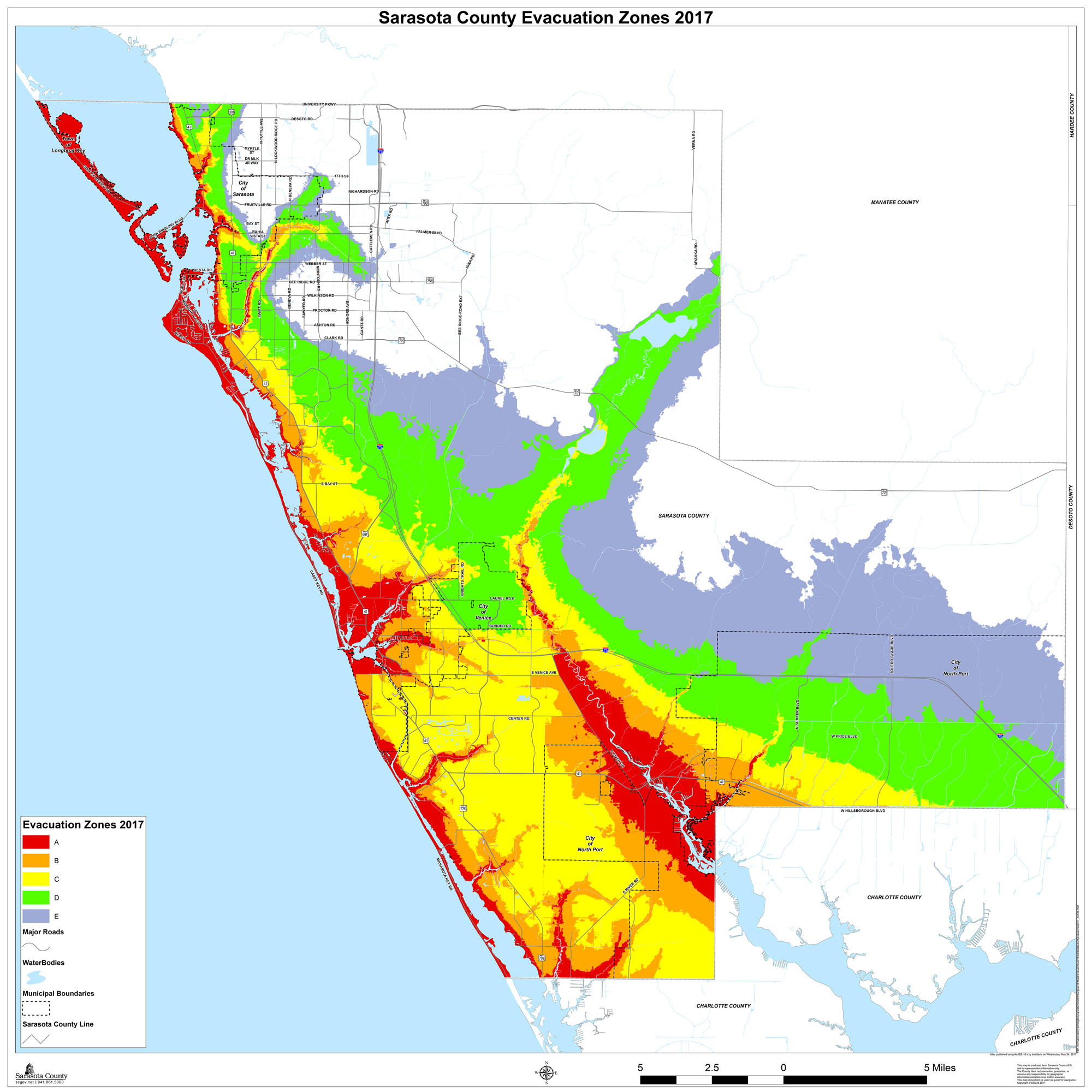
The county’s evacuation zone map for 2017 has been updated, and in case of an emergency, residents need to “know your zone” now — before it’s too late.
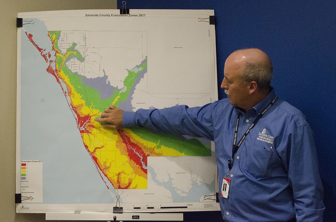
If a hurricane or other large storm were to approach the Sarasota area, Sarasota County Emergency Management Chief Ed McCrane and his staff would track its progress in tandem with state officials, and issue mandatory evacuations if necessary, based on which zones are at most risk from a predicted level of storm surge.
“The purpose [of evacuation zones] is to get people out of harm’s way that potentially could be overrun or inundated with water from the Gulf of Mexico,” McCrane said.
Storm surge is a dome of water, rising as a result of a storm’s lower atmospheric pressure and pushed ashore or into bays, inlets and rivers by storm winds. High, wind-driven surf, can heighten surge’s danger, which can penetrate well inland from the coast.
Zone A, marked red on the map, is nearest the coastline and includes all of the barrier islands, as well as areas along rivers that are prone to flooding.
The zone was identified when the National Hurricane Center reviewed a new SLOSH — sea, lake, and overland surges from hurricanes — model that looked at the paths that hundreds of potential hurricanes could take. This year’s tests also included a closer look at the topography of the area — measured within inches, instead of feet as in past years
Zone A was identified to have a potential for dangerous flooding from storm surge 10 feet above sea level. Each subsequent zone builds on the previous, culminating inland with Zone E’s 32 feet.
McCrane said the National Hurricane Center doesn’t re-examine the data every year, and the last map was issued in 2010. But this year, because of new technology and new standards, they issued a new map that puts more people in the red zone.
“Each color represents the worst case scenario for each model run,” McCrane said. “If they ran it 3,000 times in red, the worst is the one they utilized.”
If a storm was approaching, McCrane said it’s hard to tell exactly what the emergency management staff would do.
“Every storm is different. There’s no set pattern that you just go by,” he said. “We have to use the information that we have to warn people and get them out of harm’s way.
That would include monitoring the storm and issuing evacuation warnings or mandates about 48 hours before the storm would likely hit land. In the time leading up to that, teams would also begin to establish shelters and plans for evacuating people who are disabled.
Officials would also be coordinating with the National Weather Service, the state Emergency Operations Center and surrounding counties to plan and get information out.
The only time in McCrane’s 12 year history in his role that a mandatory evacuation was issued, he said, was during Tropical Storm Faye in 2008, and that was only for mobile homes. Even though in that case, the storm broke up and went around the county before coming together again.
“You do everything you can up until the point you can no longer take action,” he said, sure to point out that time always comes.
When winds are sustained at 50 miles per hour, he can’t send emergency crews to help those in need who didn’t evacuate when they should have.
At that point, everyone just has to wait.
To find what zone you’re in, go to the county’s Know Your Zone tool and type in your address.