- April 16, 2024

-
-
Loading
Loading
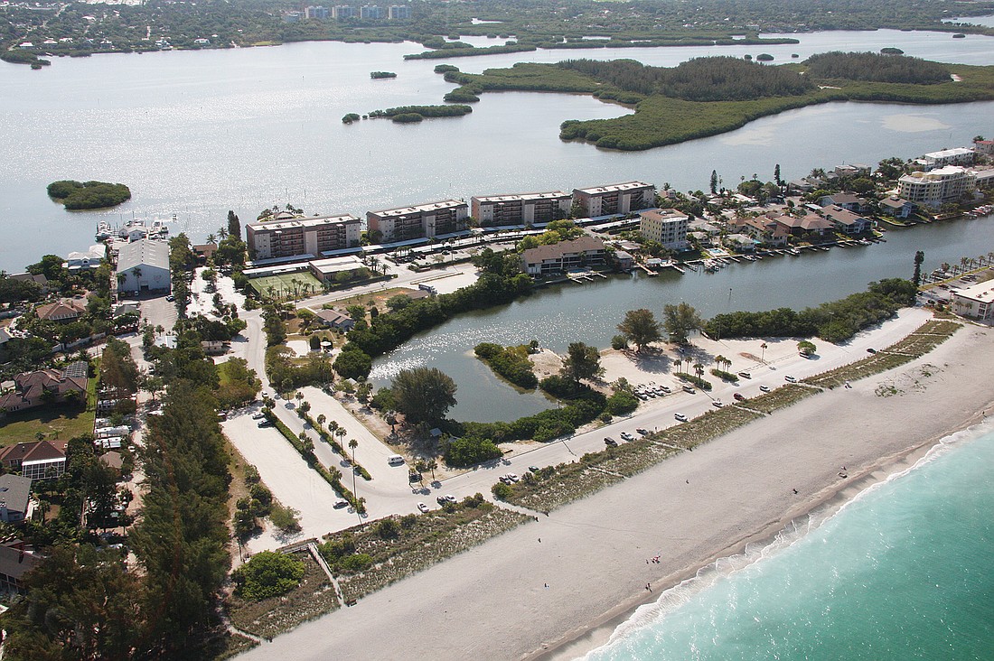
Since the renourishment of Turtle Beach was completed in 2007, county staff has been monitoring erosion on the site, knowing it was just a matter of time before another renourishment project would be necessary.
The county used tourist tax revenue to fund 45% of the 2006-07 project. The state paid for 37% of the work, and property owners along Turtle Beach are being assessed for the remaining 8% of the project, according to Laird S. Wreford, manager of the county’s Coastal Resources Department.
That assessment was to run for seven years, he added.
“As it turns out,” he wrote in an email exchange last week with the Pelican Press, “the timing will work out just right. By the time the permitting for the (next) renourishment is completed, and we are ready to pump sand, the assessment from the original nourishment will have ended.”
County Commission Chairwoman Nora Patterson told the Pelican Press that state officials determine how much funding they will allocate to a renourishment project according to a formula that takes into account how much access the public has to a particular beach.
“I always thought it was not unreasonable for the county to take approximately the same approach,” she said. “We try to make things as fair as we can” she said of balancing the public and private funding for local projects.
Already the County Commission has appropriated the necessary tourist development tax funds for the design and permitting of the next Turtle Beach renourishment, Wreford told the Pelican Press last week.
The county also has been working on a request for proposals from coastal engineering firms that can handle the design and permitting work, Wreford said. That RFP should go out within the next week or two, he added. Once the responses come in, he said, a professional services committee would review them and select a firm. At that time, Wreford said, the matter would come back before the County Commission for approval.
Patterson recently told the Siesta Key Association board that it probably would take three years to get the state permits to undertake the next Turtle Beach renourishment project. However, Wreford said that, given current efforts to streamline the state’s regulatory process, he was hopeful the process would not take that much time.
Once the permits were in hand and a construction firm was selected, he said, it would take two to three months to complete the new renourishment project.
“It was expected from the very beginning that there would be a renourishment done about every eight years,” Patterson said last week. However, she pointed out, subsequent projects should not be as extensive as the one the county undertook in 2006-07. “They put in a lot more beach to begin with,” she said, “(including) an awful lot of sand underwater,” so beach-goers would not see a dramatic drop-off when they entered the Gulf of Mexico.
Regarding monitoring the erosion at Turtle Beach, the County Commission in late September approved an amendment to its contract with the Florida Department of Environmental Protection FDEP for the 2006-07 project. Because of accounting changes, the revised total of FDEP funding was $3,955,351.02, according to a memo from Deputy County Administrator Bill Little. Of that amount, $58,115.02 is new funding for the fifth year of monitoring the beach.
Little wrote in a memo to the County Commission, that the county would have “sufficient funds to complete all required monitoring for this project.”
In the email exchange with the Pelican Press, Laird wrote, “The erosion rate over the (Turtle Beach) project area as a whole has followed the numerical model ... developed for the original permit application. The original design template showed a final beach width of 109 feet. As of August 2010 (the last monitoring event), the actual beach width was 129 feet … However, there were two erosional hot spots noted, one at each end of the project limits, with the more significant erosion measured at the south end. These project end losses were also anticipated and were discussed in public meetings from the beginning of the project development.”